Area Overview for SO19 2HW
Photos of SO19 2HW

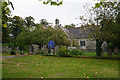
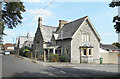
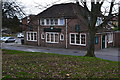
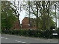
66 photos from this area
Area Information
Key information about the SO19 2HW including its size, population, and administrative classification.
- Area Type
- Postcode
- Area Size
- 1.3 hectares
- Population
- 1463
- Population Density
- 7047 people/km²
House Prices in SO19 2HW
42
Properties
£221,698
Average Sold Price
£85,500
Lowest Price
£360,000
Highest Price
Showing 42 properties
| Address | Type | Beds | Baths | Last Sale Price | Last Sale Date | |
|---|---|---|---|---|---|---|
| 129 Radstock Road, Southampton, SO19 2HW | Semi-detached | 3 | 2 | £360,000 | Jun 2025 | |
| 131A Radstock Road, Southampton, SO19 2HW | Maisonette | 1 | 1 | £155,000 | Jul 2024 | |
| 123 Radstock Road, Southampton, SO19 2HW | house | - | - | £335,000 | Jul 2024 | |
| 119 Radstock Road, Southampton, SO19 2HW | house | - | - | £296,000 | Mar 2022 | |
| 163 Radstock Road, Southampton, SO19 2HW | house | - | - | £350,000 | Dec 2021 | |
| 113 Radstock Road, Southampton, SO19 2HW | Detached | 3 | 2 | £360,000 | Mar 2021 | |
| 155 Radstock Road, Southampton, SO19 2HW | Detached | 3 | 1 | £267,000 | Nov 2020 | |
| 135 Radstock Road, Southampton, SO19 2HW | house | 3 | 2 | £242,500 | Feb 2020 | |
| 137 Radstock Road, Southampton, SO19 2HW | Semi-detached | 3 | 1 | £245,000 | Jan 2020 | |
| 133 Radstock Road, Southampton, SO19 2HW | Bungalow | 2 | 1 | £235,000 | Sep 2016 |
Page 1 of 5
Energy Efficiency in SO19 2HW
Amenities
Schools
| Rank | School | Type | Entry gender | Ages |
|---|
Explore more schools in this area
Go to Schools tabDemographics
Household Size
Family (3-5 people)
most common
Accommodation Type
Houses
most common
Tenure
70
majority
Ethnic Group
White
most common
Religion
N/A
most common
Household Composition
N/A
most common
Age
47
median
Adults (30-64 years)
most common
Household Deprivation
N/A
with no deprivation
NS-SEC
30
in Lower managerial occupations
Explore more demographic insights in this area
Go to Demographics tabPlanning
Planning Constraints
- Flood RiskPremium
- Ramsar Wetland SitesPremium
- Area of Outstanding Natural BeautyPremium
- Protected Nature ReservePremium
- Protected WoodlandPremium