Area Overview for SO19 2HH
Photos of SO19 2HH


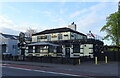

66 photos from this area
Area Information
Key information about the SO19 2HH including its size, population, and administrative classification.
- Area Type
- Postcode
- Area Size
- 4040 m²
- Population
- 1652
- Population Density
- 9198 people/km²
House Prices in SO19 2HH
26
Properties
£176,088
Average Sold Price
£49,000
Lowest Price
£275,000
Highest Price
Showing 26 properties
| Address | Type | Beds | Baths | Last Sale Price | Last Sale Date | |
|---|---|---|---|---|---|---|
| 152 Mortimer Road, Southampton, SO19 2HH | Terraced | 2 | 1 | £275,000 | Jul 2025 | |
| 140 Mortimer Road, Southampton, SO19 2HH | Terraced | 3 | 1 | £260,000 | Jul 2023 | |
| 170 Mortimer Road, Southampton, SO19 2HH | Terraced | 3 | 1 | £210,000 | Dec 2019 | |
| 162 Mortimer Road, Southampton, SO19 2HH | Terraced | 2 | 1 | £205,000 | May 2018 | |
| 154 Mortimer Road, Southampton, SO19 2HH | Terraced | 2 | 1 | £160,500 | Jun 2017 | |
| 150 Mortimer Road, Southampton, SO19 2HH | Terraced | 3 | 1 | £202,000 | May 2017 | |
| 168 Mortimer Road, Southampton, SO19 2HH | house | - | - | £225,000 | May 2017 | |
| 158 Mortimer Road, Southampton, SO19 2HH | Terraced | 2 | 1 | £190,000 | Jun 2016 | |
| 166 Mortimer Road, Southampton, SO19 2HH | Terraced | 3 | - | £187,000 | Aug 2015 | |
| 148 Mortimer Road, Southampton, SO19 2HH | house | - | - | £161,000 | Nov 2007 |
Page 1 of 3
Energy Efficiency in SO19 2HH
Amenities
Schools
| Rank | School | Type | Entry gender | Ages |
|---|
Explore more schools in this area
Go to Schools tabDemographics
Household Size
Family (3-5 people)
most common
Accommodation Type
Houses
most common
Tenure
72
majority
Ethnic Group
White
most common
Religion
N/A
most common
Household Composition
N/A
most common
Age
47
median
Adults (30-64 years)
most common
Household Deprivation
N/A
with no deprivation
NS-SEC
30
in Lower managerial occupations
Explore more demographic insights in this area
Go to Demographics tabPlanning
Planning Constraints
- Flood RiskPremium
- Ramsar Wetland SitesPremium
- Area of Outstanding Natural BeautyPremium
- Protected Nature ReservePremium
- Protected WoodlandPremium