Area Overview for SO19 1EE
Photos of SO19 1EE
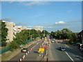
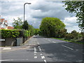
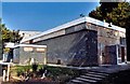
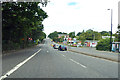
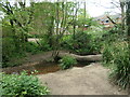
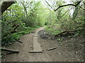
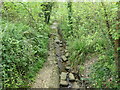
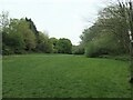
29 photos from this area
Area Information
Key information about the SO19 1EE including its size, population, and administrative classification.
- Area Type
- Postcode
- Area Size
- 7145 m²
- Population
- 1343
- Population Density
- 4969 people/km²
House Prices in SO19 1EE
21
Properties
£176,500
Average Sold Price
£42,000
Lowest Price
£240,000
Highest Price
Showing 21 properties
| Address | Type | Beds | Baths | Last Sale Price | Last Sale Date | |
|---|---|---|---|---|---|---|
| 32 Landseer Road, Southampton, SO19 1EE | Terraced | 2 | 1 | £225,000 | Dec 2022 | |
| 8 Landseer Road, Southampton, SO19 1EE | Terraced | 2 | 1 | £240,000 | Jul 2022 | |
| 16 Landseer Road, Southampton, SO19 1EE | Retail | 2 | - | £181,000 | Jan 2022 | |
| 12 Landseer Road, Southampton, SO19 1EE | house | - | - | £225,000 | Nov 2021 | |
| 14 Landseer Road, Southampton, SO19 1EE | Terraced | 3 | - | £221,000 | Sep 2021 | |
| 22 Landseer Road, Southampton, SO19 1EE | Terraced | 2 | 1 | £173,500 | May 2021 | |
| 2B Landseer Road, Southampton, SO19 1EE | Maisonette | 2 | 1 | £155,000 | Mar 2021 | |
| 2D Landseer Road, Southampton, SO19 1EE | Maisonette | - | - | £165,000 | Jan 2021 | |
| 2C Landseer Road, Southampton, SO19 1EE | Flat | - | - | £162,500 | Nov 2020 | |
| 2 Landseer Road, Southampton, SO19 1EE | Terraced | 3 | 1 | £208,000 | Sep 2020 |
Page 1 of 3
Energy Efficiency in SO19 1EE
Amenities
Schools
| Rank | School | Type | Entry gender | Ages |
|---|
Explore more schools in this area
Go to Schools tabDemographics
Household Size
One person
most common
Accommodation Type
Houses
most common
Tenure
67
majority
Ethnic Group
White
most common
Religion
N/A
most common
Household Composition
N/A
most common
Age
47
median
Adults (30-64 years)
most common
Household Deprivation
N/A
with no deprivation
NS-SEC
26
in Lower managerial occupations
Explore more demographic insights in this area
Go to Demographics tabPlanning
Planning Constraints
- Flood RiskPremium
- Ramsar Wetland SitesPremium
- Area of Outstanding Natural BeautyPremium
- Protected Nature ReservePremium
- Protected WoodlandPremium