Area Overview for SO19 0NP
Photos of SO19 0NP
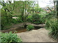
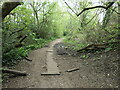
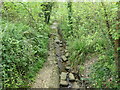
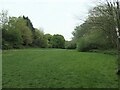
29 photos from this area
Area Information
Key information about the SO19 0NP including its size, population, and administrative classification.
- Area Type
- Postcode
- Area Size
- 1.1 hectares
- Population
- 1597
- Population Density
- 5557 people/km²
House Prices in SO19 0NP
17
Properties
£230,778
Average Sold Price
£45,000
Lowest Price
£480,000
Highest Price
Showing 17 properties
| Address | Type | Beds | Baths | Last Sale Price | Last Sale Date | |
|---|---|---|---|---|---|---|
| 153 Botley Road, Southampton, SO19 0NP | Semi-detached | 3 | 1 | £260,000 | Mar 2023 | |
| 105 Botley Road, Southampton, SO19 0NP | Detached | 4 | 2 | £480,000 | Nov 2022 | |
| 117 Botley Road, Southampton, SO19 0NP | Retail | 3 | 1 | £290,000 | Sep 2022 | |
| 119 Botley Road, Southampton, SO19 0NP | Bungalow | 2 | 1 | £225,000 | Mar 2018 | |
| 113 Botley Road, Southampton, SO19 0NP | Semi-detached | 3 | 2 | £192,000 | Oct 2017 | |
| 103 Botley Road, Southampton, SO19 0NP | Semi-detached | 3 | - | £255,000 | May 2016 | |
| 107 Botley Road, Southampton, SO19 0NP | Bungalow | 4 | 2 | £285,000 | Dec 2013 | |
| 111 Botley Road, Southampton, SO19 0NP | house | - | - | £45,000 | Mar 2000 | |
| 123 Botley Road, Southampton, SO19 0NP | house | - | - | £45,000 | Dec 1998 | |
| 109 Botley Road, Southampton, SO19 0NP | Detached | 2 | 1 | - | - |
Page 1 of 2
Energy Efficiency in SO19 0NP
Amenities
Schools
| Rank | School | Type | Entry gender | Ages |
|---|
Explore more schools in this area
Go to Schools tabDemographics
Household Size
Family (3-5 people)
most common
Accommodation Type
Houses
most common
Tenure
57
majority
Ethnic Group
White
most common
Religion
N/A
most common
Household Composition
N/A
most common
Age
47
median
Adults (30-64 years)
most common
Household Deprivation
N/A
with no deprivation
NS-SEC
23
in Lower managerial occupations
Explore more demographic insights in this area
Go to Demographics tabPlanning
Planning Constraints
- Flood RiskPremium
- Ramsar Wetland SitesPremium
- Area of Outstanding Natural BeautyPremium
- Protected Nature ReservePremium
- Protected WoodlandPremium