Area Overview for SO18 6QN
Photos of SO18 6QN

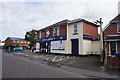
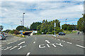

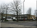
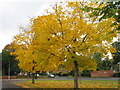
36 photos from this area
Area Information
Key information about the SO18 6QN including its size, population, and administrative classification.
- Area Type
- Postcode
- Area Size
- 1.0 hectares
- Population
- 1564
- Population Density
- 5821 people/km²
House Prices in SO18 6QN
17
Properties
£289,236
Average Sold Price
£59,995
Lowest Price
£510,000
Highest Price
Showing 17 properties
| Address | Type | Beds | Baths | Last Sale Price | Last Sale Date | |
|---|---|---|---|---|---|---|
| 191 West End Road, Southampton, SO18 6QN | Detached | 3 | 1 | £372,870 | Mar 2023 | |
| 197 West End Road, Southampton, SO18 6QN | house | - | - | £380,000 | Apr 2022 | |
| 195 West End Road, Southampton, SO18 6QN | Detached | 3 | 1 | £510,000 | May 2021 | |
| 193 West End Road, Southampton, SO18 6QN | Detached | 3 | 1 | £380,000 | Apr 2021 | |
| 185 West End Road, Southampton, SO18 6QN | Terraced | 3 | 1 | £220,000 | Oct 2016 | |
| 187 West End Road, Southampton, SO18 6QN | Detached | - | - | £390,000 | Feb 2014 | |
| 209 West End Road, Southampton, SO18 6QN | Bungalow | 2 | - | £250,000 | Jan 2014 | |
| 201 West End Road, Southampton, SO18 6QN | house | 4 | - | £473,250 | Dec 2011 | |
| 207 West End Road, Southampton, SO18 6QN | Bungalow | 3 | 2 | £250,000 | Jan 2011 | |
| 199 West End Road, Southampton, SO18 6QN | house | - | - | £324,950 | Aug 2010 |
Page 1 of 2
Energy Efficiency in SO18 6QN
Amenities
Schools
| Rank | School | Type | Entry gender | Ages |
|---|
Explore more schools in this area
Go to Schools tabDemographics
Household Size
Family (3-5 people)
most common
Accommodation Type
Houses
most common
Tenure
79
majority
Ethnic Group
White
most common
Religion
N/A
most common
Household Composition
N/A
most common
Age
47
median
Adults (30-64 years)
most common
Household Deprivation
N/A
with no deprivation
NS-SEC
30
in Lower managerial occupations
Explore more demographic insights in this area
Go to Demographics tabPlanning
Planning Constraints
- Flood RiskPremium
- Ramsar Wetland SitesPremium
- Area of Outstanding Natural BeautyPremium
- Protected Nature ReservePremium
- Protected WoodlandPremium