Area Overview for SO18 5BR
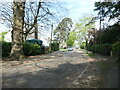
Photos of SO18 5BR
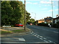


![Thornhill Park Road [A334] in SO18 5BR](https://images.propbar.co.uk/images/geograph/71/75/7175833_120.jpg)
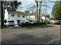
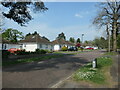
28 photos from this area
Area Information
Key information about the SO18 5BR including its size, population, and administrative classification.
- Area Type
- Postcode
- Area Size
- 1.3 hectares
- Population
- 2442
- Population Density
- 1007 people/km²
House Prices in SO18 5BR
18
Properties
£278,830
Average Sold Price
£115,000
Lowest Price
£455,000
Highest Price
Showing 18 properties
| Address | Type | Beds | Baths | Last Sale Price | Last Sale Date | |
|---|---|---|---|---|---|---|
| Pinhoe, 20 Moorhill Gardens, Thornhill, SO18 5BR | Bungalow | 2 | 2 | £415,000 | Sep 2023 | |
| 16 Moorhill Gardens, Thornhill, SO18 5BR | Bungalow | 2 | 2 | £370,000 | Mar 2023 | |
| Two Firs, 12 Moorhill Gardens, Thornhill, SO18 5BR | Bungalow | 2 | 1 | £405,000 | Nov 2022 | |
| Blythewood, 13 Moorhill Gardens, Thornhill, SO18 5BR | Bungalow | - | - | £455,000 | Aug 2021 | |
| 8 Moorhill Gardens, Southampton, SO18 5BR | Bungalow | 3 | 2 | £350,000 | Jul 2020 | |
| Woodlands, 21 Moorhill Gardens, Thornhill, SO18 5BR | Bungalow | 2 | - | £200,000 | Aug 2013 | |
| 18 Moorhill Gardens, Thornhill, SO18 5BR | Bungalow | 2 | 1 | £225,000 | May 2013 | |
| 22 Moorhill Gardens, Thornhill, SO18 5BR | Bungalow | 2 | 2 | £215,000 | Feb 2013 | |
| Greenways, 23 Moorhill Gardens, Thornhill, SO18 5BR | Bungalow | - | - | £217,500 | Jul 2009 | |
| 9 Moorhill Gardens, Southampton, SO18 5BR | Bungalow | 3 | 1 | £299,950 | Jul 2008 |
Page 1 of 2
Energy Efficiency in SO18 5BR
Amenities
Schools
| Rank | School | Type | Entry gender | Ages |
|---|
Explore more schools in this area
Go to Schools tabDemographics
Household Size
Family (3-5 people)
most common
Accommodation Type
Houses
most common
Tenure
75
majority
Ethnic Group
White
most common
Religion
N/A
most common
Household Composition
N/A
most common
Age
47
median
Adults (30-64 years)
most common
Household Deprivation
N/A
with no deprivation
NS-SEC
40
in Lower managerial occupations
Explore more demographic insights in this area
Go to Demographics tabPlanning
Planning Constraints
- Flood RiskPremium
- Ramsar Wetland SitesPremium
- Area of Outstanding Natural BeautyPremium
- Protected Nature ReservePremium
- Protected WoodlandPremium