Area Overview for SO18 4SN
Photos of SO18 4SN
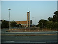
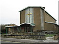
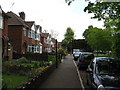


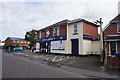


36 photos from this area
Area Information
Key information about the SO18 4SN including its size, population, and administrative classification.
- Area Type
- Postcode
- Area Size
- 7177 m²
- Population
- 1671
- Population Density
- 4996 people/km²
House Prices in SO18 4SN
14
Properties
£145,716
Average Sold Price
£57,950
Lowest Price
£257,000
Highest Price
Showing 14 properties
| Address | Type | Beds | Baths | Last Sale Price | Last Sale Date | |
|---|---|---|---|---|---|---|
| 101 Macarthur Crescent, Southampton, SO18 4SN | Terraced | 3 | - | £245,000 | Dec 2023 | |
| 99 Macarthur Crescent, Southampton, SO18 4SN | Terraced | 3 | 1 | £257,000 | Nov 2022 | |
| 119 Macarthur Crescent, Southampton, SO18 4SN | Semi-detached | - | - | £153,500 | Aug 2007 | |
| 103 Macarthur Crescent, Southampton, SO18 4SN | house | 3 | - | £137,000 | Dec 2006 | |
| 113 Macarthur Crescent, Southampton, SO18 4SN | house | - | - | £138,500 | Dec 2004 | |
| 115 Macarthur Crescent, Southampton, SO18 4SN | Semi-detached | - | - | £138,500 | Sep 2004 | |
| 111 Macarthur Crescent, Southampton, SO18 4SN | Terraced | - | - | £124,000 | Jun 2003 | |
| 107 Macarthur Crescent, Southampton, SO18 4SN | Terraced | - | - | £57,950 | Nov 1998 | |
| 105 Macarthur Crescent, Southampton, SO18 4SN | Terraced | - | - | £59,995 | Oct 1997 | |
| 121 Macarthur Crescent, Southampton, SO18 4SN | Semi-detached | - | - | - | - |
Page 1 of 2
Energy Efficiency in SO18 4SN
Amenities
Schools
| Rank | School | Type | Entry gender | Ages |
|---|
Explore more schools in this area
Go to Schools tabDemographics
Household Size
Family (3-5 people)
most common
Accommodation Type
Houses
most common
Tenure
73
majority
Ethnic Group
White
most common
Religion
N/A
most common
Household Composition
N/A
most common
Age
47
median
Adults (30-64 years)
most common
Household Deprivation
N/A
with no deprivation
NS-SEC
28
in Lower managerial occupations
Explore more demographic insights in this area
Go to Demographics tabPlanning
Planning Constraints
- Flood RiskPremium
- Ramsar Wetland SitesPremium
- Area of Outstanding Natural BeautyPremium
- Protected Nature ReservePremium
- Protected WoodlandPremium