Area Overview for SO18 3JY
Photos of SO18 3JY
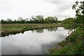
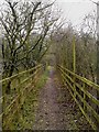

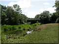
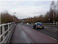
38 photos from this area
Area Information
Key information about the SO18 3JY including its size, population, and administrative classification.
- Area Type
- Postcode
- Area Size
- 9647 m²
- Population
- 1453
- Population Density
- 5338 people/km²
House Prices in SO18 3JY
37
Properties
£151,056
Average Sold Price
£33,000
Lowest Price
£322,500
Highest Price
Showing 37 properties
| Address | Type | Beds | Baths | Last Sale Price | Last Sale Date | |
|---|---|---|---|---|---|---|
| 18 Kennet Close, West End, SO18 3JY | Flat | 1 | 1 | £105,000 | Feb 2025 | |
| 37 Kennet Close, West End, SO18 3JY | Terraced | 3 | 1 | £322,500 | Nov 2024 | |
| 23 Kennet Close, West End, SO18 3JY | Flat | 1 | 1 | £150,000 | Aug 2024 | |
| 15 Kennet Close, West End, SO18 3JY | Maisonette | 1 | 1 | £130,000 | Dec 2023 | |
| 36 Kennet Close, West End, SO18 3JY | Terraced | 2 | 1 | £269,950 | Jun 2023 | |
| 17 Kennet Close, West End, SO18 3JY | Maisonette | 1 | 1 | £140,000 | Oct 2022 | |
| 32 Kennet Close, West End, SO18 3JY | Terraced | 2 | 1 | £261,000 | Aug 2022 | |
| 11 Kennet Close, West End, SO18 3JY | Maisonette | 1 | 1 | £142,500 | Jul 2022 | |
| 2 Kennet Close, West End, SO18 3JY | house | 2 | 1 | £243,000 | May 2022 | |
| 4 Kennet Close, West End, SO18 3JY | Terraced | 1 | 1 | £265,000 | Jan 2022 |
Page 1 of 4
Energy Efficiency in SO18 3JY
Amenities
Schools
| Rank | School | Type | Entry gender | Ages |
|---|
Explore more schools in this area
Go to Schools tabDemographics
Household Size
One person
most common
Accommodation Type
Houses
most common
Tenure
62
majority
Ethnic Group
White
most common
Religion
N/A
most common
Household Composition
N/A
most common
Age
47
median
Adults (30-64 years)
most common
Household Deprivation
N/A
with no deprivation
NS-SEC
33
in Lower managerial occupations
Explore more demographic insights in this area
Go to Demographics tabPlanning
Planning Constraints
- Flood RiskPremium
- Ramsar Wetland SitesPremium
- Area of Outstanding Natural BeautyPremium
- Protected Nature ReservePremium
- Protected WoodlandPremium