Area Overview for SO18 2RD
Photos of SO18 2RD


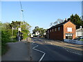
38 photos from this area
Area Information
Key information about the SO18 2RD including its size, population, and administrative classification.
- Area Type
- Postcode
- Area Size
- 8.3 hectares
- Population
- 1423
- Population Density
- 2570 people/km²
House Prices in SO18 2RD
56
Properties
£196,632
Average Sold Price
£55,500
Lowest Price
£405,000
Highest Price
Showing 56 properties
| Address | Type | Beds | Baths | Last Sale Price | Last Sale Date | |
|---|---|---|---|---|---|---|
| 53 Wilmington Close, Southampton, SO18 2RD | Semi-detached | 3 | 1 | £350,000 | May 2025 | |
| 8 Wilmington Close, Southampton, SO18 2RD | Detached | 3 | 2 | £405,000 | Mar 2024 | |
| 35 Wilmington Close, Southampton, SO18 2RD | house | 2 | 1 | £255,000 | Jul 2023 | |
| 30 Wilmington Close, Southampton, SO18 2RD | Semi-detached | 3 | 1 | £330,000 | Sep 2022 | |
| 52 Wilmington Close, Southampton, SO18 2RD | Semi-detached | 3 | 1 | £253,000 | Jun 2020 | |
| 39 Wilmington Close, Southampton, SO18 2RD | Detached | 4 | 1 | £263,000 | May 2019 | |
| 16 Wilmington Close, Southampton, SO18 2RD | Detached | 4 | 2 | £275,000 | Aug 2018 | |
| 3 Wilmington Close, Southampton, SO18 2RD | Detached | 4 | 2 | £318,000 | Feb 2018 | |
| 2 Wilmington Close, Southampton, SO18 2RD | Detached | 4 | 2 | £325,000 | Apr 2017 | |
| 45 Wilmington Close, Southampton, SO18 2RD | Semi-detached | 3 | 1 | £257,840 | Dec 2016 |
Page 1 of 6
Energy Efficiency in SO18 2RD
Amenities
Schools
| Rank | School | Type | Entry gender | Ages |
|---|
Explore more schools in this area
Go to Schools tabDemographics
Household Size
Two person
most common
Accommodation Type
Houses
most common
Tenure
86
majority
Ethnic Group
White
most common
Religion
N/A
most common
Household Composition
N/A
most common
Age
47
median
Adults (30-64 years)
most common
Household Deprivation
N/A
with no deprivation
NS-SEC
32
in Lower managerial occupations
Explore more demographic insights in this area
Go to Demographics tabPlanning
Planning Constraints
- Flood RiskPremium
- Ramsar Wetland SitesPremium
- Area of Outstanding Natural BeautyPremium
- Protected Nature ReservePremium
- Protected WoodlandPremium