Area Overview for SO18 2PF
Photos of SO18 2PF
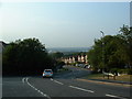
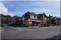
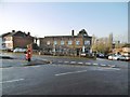
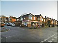

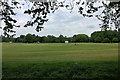
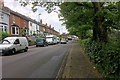
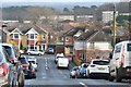
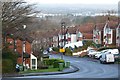
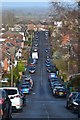
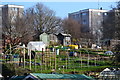
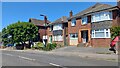
21 photos from this area
Area Information
Key information about the SO18 2PF including its size, population, and administrative classification.
- Area Type
- Postcode
- Area Size
- 1.5 hectares
- Population
- 1504
- Population Density
- 2753 people/km²
House Prices in SO18 2PF
42
Properties
£200,900
Average Sold Price
£47,000
Lowest Price
£435,000
Highest Price
Showing 42 properties
| Address | Type | Beds | Baths | Last Sale Price | Last Sale Date | |
|---|---|---|---|---|---|---|
| 142 Woodmill Lane, Southampton, SO18 2PF | Semi-detached | 4 | 2 | £435,000 | Mar 2025 | |
| 118 Woodmill Lane, Southampton, SO18 2PF | Bungalow | 3 | 1 | £325,000 | Mar 2025 | |
| 116 Woodmill Lane, Southampton, SO18 2PF | Bungalow | 3 | 1 | £267,000 | Feb 2024 | |
| 94 Woodmill Lane, Southampton, SO18 2PF | Bungalow | 2 | 1 | £275,000 | May 2023 | |
| 158 Woodmill Lane, Southampton, SO18 2PF | Maisonette | 2 | 1 | £198,000 | Apr 2023 | |
| 108 Woodmill Lane, Southampton, SO18 2PF | Bungalow | 2 | 1 | £278,000 | Dec 2022 | |
| 152 Woodmill Lane, Southampton, SO18 2PF | Flat | 2 | 1 | £188,000 | Oct 2021 | |
| 144 Woodmill Lane, Southampton, SO18 2PF | house | - | - | £290,000 | Feb 2021 | |
| 150 Woodmill Lane, Southampton, SO18 2PF | Maisonette | 2 | 1 | £160,000 | Dec 2020 | |
| 96 Woodmill Lane, Southampton, SO18 2PF | Bungalow | 2 | 1 | £208,500 | Sep 2019 |
Page 1 of 5
Energy Efficiency in SO18 2PF
Amenities
Schools
| Rank | School | Type | Entry gender | Ages |
|---|
Explore more schools in this area
Go to Schools tabDemographics
Household Size
Family (3-5 people)
most common
Accommodation Type
Houses
most common
Tenure
77
majority
Ethnic Group
White
most common
Religion
N/A
most common
Household Composition
N/A
most common
Age
47
median
Adults (30-64 years)
most common
Household Deprivation
N/A
with no deprivation
NS-SEC
37
in Lower managerial occupations
Explore more demographic insights in this area
Go to Demographics tabPlanning
Planning Constraints
- Flood RiskPremium
- Ramsar Wetland SitesPremium
- Area of Outstanding Natural BeautyPremium
- Protected Nature ReservePremium
- Protected WoodlandPremium