Area Overview for SO18 2JJ
Photos of SO18 2JJ
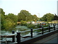
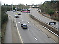
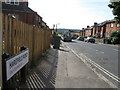
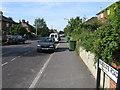
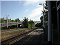
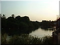
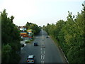
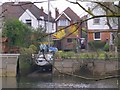
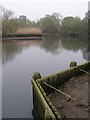
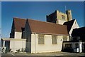
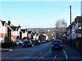

86 photos from this area
Area Information
Key information about the SO18 2JJ including its size, population, and administrative classification.
- Area Type
- Postcode
- Area Size
- 7506 m²
- Population
- 1292
- Population Density
- 4327 people/km²
House Prices in SO18 2JJ
21
Properties
£246,775
Average Sold Price
£185,000
Lowest Price
£387,000
Highest Price
Showing 21 properties
| Address | Type | Beds | Baths | Last Sale Price | Last Sale Date | |
|---|---|---|---|---|---|---|
| 301 Woodmill Lane, Southampton, SO18 2JJ | house | 5 | 1 | £324,000 | Jun 2024 | |
| 311 Woodmill Lane, Southampton, SO18 2JJ | Semi-detached | 3 | 1 | £345,800 | Mar 2023 | |
| 327 Woodmill Lane, Southampton, SO18 2JJ | house | 3 | - | £387,000 | Jun 2021 | |
| 305 Woodmill Lane, Southampton, SO18 2JJ | house | - | - | £245,000 | Oct 2020 | |
| 329 Woodmill Lane, Southampton, SO18 2JJ | Detached | 3 | - | £233,000 | Oct 2015 | |
| 317 Woodmill Lane, Southampton, SO18 2JJ | Detached | 3 | 1 | £249,000 | Oct 2014 | |
| 319 Woodmill Lane, Southampton, SO18 2JJ | house | - | - | £200,000 | Aug 2011 | |
| 309 Woodmill Lane, Southampton, SO18 2JJ | house | - | - | £190,000 | Oct 2009 | |
| 321 Woodmill Lane, Southampton, SO18 2JJ | house | - | - | £220,000 | Jan 2007 | |
| 335 Woodmill Lane, Southampton, SO18 2JJ | Semi-detached | 5 | 5 | £185,000 | Sep 2004 |
Page 1 of 3
Energy Efficiency in SO18 2JJ
Amenities
Schools
| Rank | School | Type | Entry gender | Ages |
|---|
Explore more schools in this area
Go to Schools tabDemographics
Household Size
Family (3-5 people)
most common
Accommodation Type
Houses
most common
Tenure
36
majority
Ethnic Group
White
most common
Religion
N/A
most common
Household Composition
N/A
most common
Age
22
median
Young Adults (15-29 years)
most common
Household Deprivation
N/A
with no deprivation
NS-SEC
20
in Lower managerial occupations
Explore more demographic insights in this area
Go to Demographics tabPlanning
Planning Constraints
- Flood RiskPremium
- Ramsar Wetland SitesPremium
- Area of Outstanding Natural BeautyPremium
- Protected Nature ReservePremium
- Protected WoodlandPremium