Area Overview for SO18 2EJ
Photos of SO18 2EJ


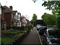


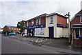


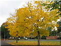

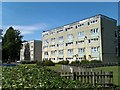
36 photos from this area
Area Information
Key information about the SO18 2EJ including its size, population, and administrative classification.
- Area Type
- Postcode
- Area Size
- 3156 m²
- Population
- 1737
- Population Density
- 7950 people/km²
House Prices in SO18 2EJ
23
Properties
£93,750
Average Sold Price
£72,500
Lowest Price
£115,000
Highest Price
Showing 23 properties
| Address | Type | Beds | Baths | Last Sale Price | Last Sale Date | |
|---|---|---|---|---|---|---|
| 112 Vanguard Road, Southampton, SO18 2EJ | Maisonette | 2 | 1 | £115,000 | May 2020 | |
| 132 Vanguard Road, Southampton, SO18 2EJ | Flat | - | - | £72,500 | Oct 2013 | |
| Glass Bank Igloo Adjacent 100 To 120, Vanguard Road, Southampton, SO18 2EJ | commercial | - | - | - | - | |
| 102 Vanguard Road, Southampton, SO18 2EJ | Flat | - | - | - | - | |
| 108 Vanguard Road, Southampton, SO18 2EJ | Maisonette | - | - | - | - | |
| 130 Vanguard Road, Southampton, SO18 2EJ | Maisonette | - | - | - | - | |
| 114 Vanguard Road, Southampton, SO18 2EJ | Maisonette | - | - | - | - | |
| 136 Vanguard Road, Southampton, SO18 2EJ | Maisonette | - | - | - | - | |
| 106 Vanguard Road, Southampton, SO18 2EJ | Maisonette | - | - | - | - | |
| 116 Vanguard Road, Southampton, SO18 2EJ | Maisonette | - | - | - | - |
Page 1 of 3
Energy Efficiency in SO18 2EJ
Amenities
Schools
| Rank | School | Type | Entry gender | Ages |
|---|
Explore more schools in this area
Go to Schools tabDemographics
Household Size
Family (3-5 people)
most common
Accommodation Type
Flats
most common
Tenure
35
majority
Ethnic Group
White
most common
Religion
N/A
most common
Household Composition
N/A
most common
Age
47
median
Adults (30-64 years)
most common
Household Deprivation
N/A
with no deprivation
NS-SEC
22
in Lower managerial occupations
Explore more demographic insights in this area
Go to Demographics tabPlanning
Planning Constraints
- Flood RiskPremium
- Ramsar Wetland SitesPremium
- Area of Outstanding Natural BeautyPremium
- Protected Nature ReservePremium
- Protected WoodlandPremium