Area Overview for SO18 2AQ
Photos of SO18 2AQ
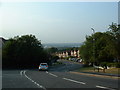
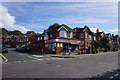
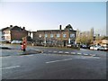
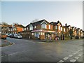

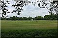
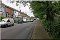
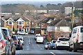
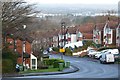
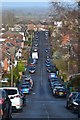
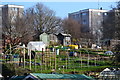
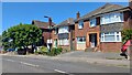
21 photos from this area
Area Information
Key information about the SO18 2AQ including its size, population, and administrative classification.
- Area Type
- Postcode
- Area Size
- 7181 m²
- Population
- 1571
- Population Density
- 6092 people/km²
House Prices in SO18 2AQ
23
Properties
£221,600
Average Sold Price
£100,000
Lowest Price
£371,000
Highest Price
Showing 23 properties
| Address | Type | Beds | Baths | Last Sale Price | Last Sale Date | |
|---|---|---|---|---|---|---|
| 17 Cornwall Crescent, Southampton, SO18 2AQ | Detached | 3 | 1 | £371,000 | Aug 2025 | |
| 1 Cornwall Crescent, Southampton, SO18 2AQ | Semi-detached | 3 | 1 | £245,000 | Jun 2024 | |
| 6 Cornwall Crescent, Southampton, SO18 2AQ | house | - | - | £330,000 | Sep 2021 | |
| 8 Cornwall Crescent, Southampton, SO18 2AQ | Detached | 3 | 1 | £288,000 | Jan 2021 | |
| 21 Cornwall Crescent, Southampton, SO18 2AQ | Detached | 3 | 2 | £210,000 | Jun 2014 | |
| 10 Cornwall Crescent, Southampton, SO18 2AQ | house | - | - | £190,000 | Apr 2013 | |
| 2 Cornwall Crescent, Southampton, SO18 2AQ | house | - | - | £122,000 | Mar 2007 | |
| 7 Cornwall Crescent, Southampton, SO18 2AQ | Detached | - | - | £178,000 | Jul 2006 | |
| 13 Cornwall Crescent, Southampton, SO18 2AQ | Detached | - | - | £182,000 | May 2005 | |
| 15 Cornwall Crescent, Southampton, SO18 2AQ | house | - | - | £100,000 | May 2001 |
Page 1 of 3
Energy Efficiency in SO18 2AQ
Amenities
Schools
| Rank | School | Type | Entry gender | Ages |
|---|
Explore more schools in this area
Go to Schools tabDemographics
Household Size
Family (3-5 people)
most common
Accommodation Type
Houses
most common
Tenure
69
majority
Ethnic Group
White
most common
Religion
N/A
most common
Household Composition
N/A
most common
Age
47
median
Adults (30-64 years)
most common
Household Deprivation
N/A
with no deprivation
NS-SEC
33
in Lower managerial occupations
Explore more demographic insights in this area
Go to Demographics tabPlanning
Planning Constraints
- Flood RiskPremium
- Ramsar Wetland SitesPremium
- Area of Outstanding Natural BeautyPremium
- Protected Nature ReservePremium
- Protected WoodlandPremium