Area Overview for SO18 1PJ
Photos of SO18 1PJ
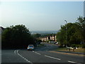
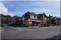
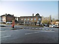
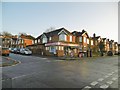

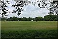
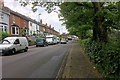
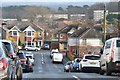
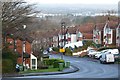
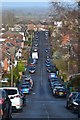
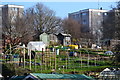
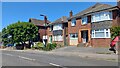
21 photos from this area
Area Information
Key information about the SO18 1PJ including its size, population, and administrative classification.
- Area Type
- Postcode
- Area Size
- 1.2 hectares
- Population
- 1504
- Population Density
- 2753 people/km²
House Prices in SO18 1PJ
35
Properties
£219,691
Average Sold Price
£63,000
Lowest Price
£371,000
Highest Price
Showing 35 properties
| Address | Type | Beds | Baths | Last Sale Price | Last Sale Date | |
|---|---|---|---|---|---|---|
| 67 Oaktree Road, Southampton, SO18 1PJ | Semi-detached | 3 | 1 | £272,500 | Mar 2025 | |
| 61 Oaktree Road, Southampton, SO18 1PJ | Detached | 3 | 1 | £345,000 | Jan 2024 | |
| 109 Oaktree Road, Southampton, SO18 1PJ | Flat | 2 | 2 | £232,500 | Apr 2023 | |
| 103 Oaktree Road, Southampton, SO18 1PJ | house | - | - | £371,000 | Aug 2022 | |
| 111 Oaktree Road, Southampton, SO18 1PJ | Semi-detached | 3 | - | £321,000 | Jun 2021 | |
| 113 Oaktree Road, Southampton, SO18 1PJ | Semi-detached | 5 | 3 | £371,000 | Mar 2021 | |
| 51 Oaktree Road, Southampton, SO18 1PJ | Detached | 3 | 1 | £305,000 | Jul 2019 | |
| 87 Oaktree Road, Southampton, SO18 1PJ | house | 3 | 1 | £295,000 | Apr 2019 | |
| 91 Oaktree Road, Southampton, SO18 1PJ | Semi-detached | 3 | 1 | £234,000 | Aug 2015 | |
| 53 Oaktree Road, Southampton, SO18 1PJ | Semi-detached | 3 | 2 | £224,950 | May 2014 |
Page 1 of 4
Energy Efficiency in SO18 1PJ
Amenities
Schools
| Rank | School | Type | Entry gender | Ages |
|---|
Explore more schools in this area
Go to Schools tabDemographics
Household Size
Family (3-5 people)
most common
Accommodation Type
Houses
most common
Tenure
77
majority
Ethnic Group
White
most common
Religion
N/A
most common
Household Composition
N/A
most common
Age
47
median
Adults (30-64 years)
most common
Household Deprivation
N/A
with no deprivation
NS-SEC
37
in Lower managerial occupations
Explore more demographic insights in this area
Go to Demographics tabPlanning
Planning Constraints
- Flood RiskPremium
- Ramsar Wetland SitesPremium
- Area of Outstanding Natural BeautyPremium
- Protected Nature ReservePremium
- Protected WoodlandPremium