Area Overview for SO18 1JX
Photos of SO18 1JX
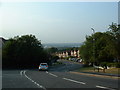
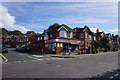
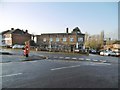
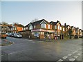

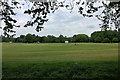
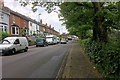
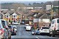
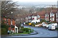
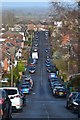
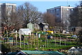
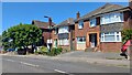
21 photos from this area
Area Information
Key information about the SO18 1JX including its size, population, and administrative classification.
- Area Type
- Postcode
- Area Size
- 5717 m²
- Population
- 1504
- Population Density
- 2753 people/km²
House Prices in SO18 1JX
19
Properties
£186,718
Average Sold Price
£79,950
Lowest Price
£355,000
Highest Price
Showing 19 properties
| Address | Type | Beds | Baths | Last Sale Price | Last Sale Date | |
|---|---|---|---|---|---|---|
| 124 Dimond Road, Southampton, SO18 1JX | Detached | 3 | 1 | £338,000 | Mar 2025 | |
| 98 Dimond Road, Southampton, SO18 1JX | house | - | - | £355,000 | Mar 2023 | |
| 116 Dimond Road, Southampton, SO18 1JX | house | - | - | £182,000 | Sep 2019 | |
| 118 Dimond Road, Southampton, SO18 1JX | Semi-detached | 3 | 2 | £275,000 | Nov 2018 | |
| 100 Dimond Road, Southampton, SO18 1JX | Semi-detached | - | - | £174,500 | Dec 2006 | |
| 128 Dimond Road, Southampton, SO18 1JX | Detached | 3 | 2 | £169,000 | Jun 2004 | |
| 112 Dimond Road, Southampton, SO18 1JX | house | - | - | £154,950 | Sep 2003 | |
| 106 Dimond Road, Southampton, SO18 1JX | Semi-detached | 3 | 1 | £108,500 | Apr 2002 | |
| 126 Dimond Road, Southampton, SO18 1JX | Semi-detached | - | - | £113,000 | Feb 2002 | |
| 104 Dimond Road, Southampton, SO18 1JX | Semi-detached | - | - | £104,000 | Oct 2000 |
Page 1 of 2
Energy Efficiency in SO18 1JX
Amenities
Schools
| Rank | School | Type | Entry gender | Ages |
|---|
Explore more schools in this area
Go to Schools tabDemographics
Household Size
Family (3-5 people)
most common
Accommodation Type
Houses
most common
Tenure
77
majority
Ethnic Group
White
most common
Religion
N/A
most common
Household Composition
N/A
most common
Age
47
median
Adults (30-64 years)
most common
Household Deprivation
N/A
with no deprivation
NS-SEC
37
in Lower managerial occupations
Explore more demographic insights in this area
Go to Demographics tabPlanning
Planning Constraints
- Flood RiskPremium
- Ramsar Wetland SitesPremium
- Area of Outstanding Natural BeautyPremium
- Protected Nature ReservePremium
- Protected WoodlandPremium