Area Overview for SO17 3SL
Photos of SO17 3SL
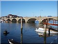
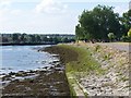
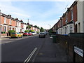
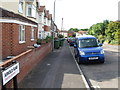
100 photos from this area
Area Information
Key information about the SO17 3SL including its size, population, and administrative classification.
- Area Type
- Postcode
- Area Size
- 3007 m²
- Population
- 1345
- Population Density
- 8899 people/km²
House Prices in SO17 3SL
16
Properties
£115,700
Average Sold Price
£37,500
Lowest Price
£164,000
Highest Price
Showing 16 properties
| Address | Type | Beds | Baths | Last Sale Price | Last Sale Date | |
|---|---|---|---|---|---|---|
| 619 Portswood Road, Southampton, SO17 3SL | Flat | - | - | £163,000 | Jan 2023 | |
| 621 Portswood Road, Southampton, SO17 3SL | Flat | 2 | 1 | £164,000 | Oct 2022 | |
| 623 Portswood Road, Southampton, SO17 3SL | Flat | 2 | 1 | £137,000 | May 2019 | |
| 609 Portswood Road, Southampton, SO17 3SL | Flat | - | - | £77,000 | Mar 2002 | |
| 605 Portswood Road, Southampton, SO17 3SL | Flat | - | - | £37,500 | Mar 1999 | |
| 601 Portswood Road, Southampton, SO17 3SL | Semi-detached | 5 | 2 | - | - | |
| 615 Portswood Road, Southampton, SO17 3SL | Flat | - | - | - | - | |
| 613 Portswood Road, Southampton, SO17 3SL | Flat | - | - | - | - | |
| 607 Portswood Road, Southampton, SO17 3SL | house | - | - | - | - | |
| 603 Portswood Road, Southampton, SO17 3SL | Flat | - | - | - | - |
Page 1 of 2
Energy Efficiency in SO17 3SL
Amenities
Schools
| Rank | School | Type | Entry gender | Ages |
|---|
Explore more schools in this area
Go to Schools tabDemographics
Household Size
Family (3-5 people)
most common
Accommodation Type
Houses
most common
Tenure
19
majority
Ethnic Group
White
most common
Religion
N/A
most common
Household Composition
N/A
most common
Age
22
median
Young Adults (15-29 years)
most common
Household Deprivation
N/A
with no deprivation
NS-SEC
11
in Lower managerial occupations
Explore more demographic insights in this area
Go to Demographics tabPlanning
Planning Constraints
- Flood RiskPremium
- Ramsar Wetland SitesPremium
- Area of Outstanding Natural BeautyPremium
- Protected Nature ReservePremium
- Protected WoodlandPremium