Area Overview for SO17 2HY
Photos of SO17 2HY
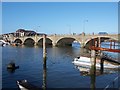

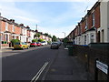
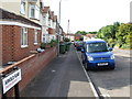
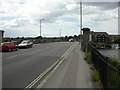


100 photos from this area
Area Information
Key information about the SO17 2HY including its size, population, and administrative classification.
- Area Type
- Postcode
- Area Size
- 5620 m²
- Population
- 1478
- Population Density
- 6968 people/km²
House Prices in SO17 2HY
51
Properties
£193,563
Average Sold Price
£154,000
Lowest Price
£252,000
Highest Price
Showing 51 properties
| Address | Type | Beds | Baths | Last Sale Price | Last Sale Date | |
|---|---|---|---|---|---|---|
| 149 Adelaide Road, Southampton, SO17 2HY | Semi-detached | 2 | 1 | £252,000 | Jul 2025 | |
| 153 Adelaide Road, Southampton, SO17 2HY | Flat | 1 | 1 | £176,000 | Aug 2022 | |
| 129 Adelaide Road, Southampton, SO17 2HY | Semi-detached | 2 | 1 | £225,000 | May 2020 | |
| 127 Adelaide Road, Southampton, SO17 2HY | Semi-detached | 1 | 1 | £207,500 | Sep 2019 | |
| 147 Adelaide Road, Southampton, SO17 2HY | Semi-detached | 3 | - | £195,000 | Dec 2015 | |
| 121 Adelaide Road, Southampton, SO17 2HY | house | 3 | - | £172,500 | Mar 2015 | |
| 131 Adelaide Road, Southampton, SO17 2HY | house | 3 | - | £166,500 | Nov 2014 | |
| 123 Adelaide Road, Southampton, SO17 2HY | Semi-detached | 3 | 2 | £154,000 | Jan 2008 | |
| Gladstone Villa, 143 Adelaide Road, Southampton, SO17 2HY | Detached | 4 | 2 | - | - | |
| 133 Adelaide Road, Southampton, SO17 2HY | Terraced | 4 | 1 | - | - |
Page 1 of 6
Energy Efficiency in SO17 2HY
Amenities
Schools
| Rank | School | Type | Entry gender | Ages |
|---|
Explore more schools in this area
Go to Schools tabDemographics
Household Size
One person
most common
Accommodation Type
Houses
most common
Tenure
41
majority
Ethnic Group
White
most common
Religion
N/A
most common
Household Composition
N/A
most common
Age
47
median
Adults (30-64 years)
most common
Household Deprivation
N/A
with no deprivation
NS-SEC
29
in Lower managerial occupations
Explore more demographic insights in this area
Go to Demographics tabPlanning
Planning Constraints
- Flood RiskPremium
- Ramsar Wetland SitesPremium
- Area of Outstanding Natural BeautyPremium
- Protected Nature ReservePremium
- Protected WoodlandPremium