Area Overview for SO17 1QJ
Photos of SO17 1QJ
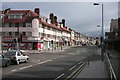
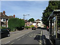
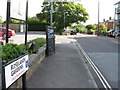
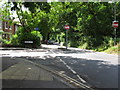
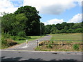
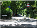
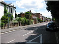
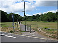
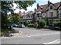
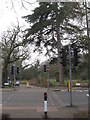
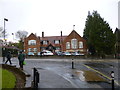

87 photos from this area
Area Information
Key information about the SO17 1QJ including its size, population, and administrative classification.
- Area Type
- Postcode
- Area Size
- 1.6 hectares
- Population
- 1252
- Population Density
- 5645 people/km²
House Prices in SO17 1QJ
62
Properties
£272,966
Average Sold Price
£58,000
Lowest Price
£560,000
Highest Price
Showing 62 properties
| Address | Type | Beds | Baths | Last Sale Price | Last Sale Date | |
|---|---|---|---|---|---|---|
| 51 Roselands Gardens, Southampton, SO17 1QJ | Terraced | 2 | 2 | £318,000 | Jan 2025 | |
| 79 Roselands Gardens, Southampton, SO17 1QJ | Semi-detached | 3 | 1 | £350,000 | Jun 2023 | |
| 49A Roselands Gardens, Southampton, SO17 1QJ | Retail | 2 | 1 | £560,000 | Jun 2022 | |
| 85 Roselands Gardens, Southampton, SO17 1QJ | Semi-detached | 3 | 1 | £145,000 | Mar 2022 | |
| 60 Roselands Gardens, Southampton, SO17 1QJ | Terraced | 3 | 1 | £370,000 | Dec 2021 | |
| 81 Roselands Gardens, Southampton, SO17 1QJ | Semi-detached | 2 | - | £327,500 | Nov 2021 | |
| 82 Roselands Gardens, Southampton, SO17 1QJ | Detached | 2 | 1 | £343,000 | Aug 2021 | |
| 63 Roselands Gardens, Southampton, SO17 1QJ | house | 3 | - | £280,000 | Jun 2021 | |
| 61 Roselands Gardens, Southampton, SO17 1QJ | Terraced | 3 | 1 | £326,000 | Jun 2021 | |
| 52 Roselands Gardens, Southampton, SO17 1QJ | house | 3 | 1 | £325,000 | Jun 2021 |
Page 1 of 7
Energy Efficiency in SO17 1QJ
Amenities
Schools
| Rank | School | Type | Entry gender | Ages |
|---|
Explore more schools in this area
Go to Schools tabDemographics
Household Size
Family (3-5 people)
most common
Accommodation Type
Houses
most common
Tenure
55
majority
Ethnic Group
White
most common
Religion
N/A
most common
Household Composition
N/A
most common
Age
47
median
Adults (30-64 years)
most common
Household Deprivation
N/A
with no deprivation
NS-SEC
41
in Lower managerial occupations
Explore more demographic insights in this area
Go to Demographics tabPlanning
Planning Constraints
- Flood RiskPremium
- Ramsar Wetland SitesPremium
- Area of Outstanding Natural BeautyPremium
- Protected Nature ReservePremium
- Protected WoodlandPremium