Area Overview for SO17 1DN
Photos of SO17 1DN
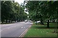
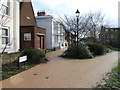
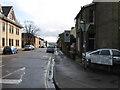

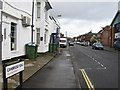
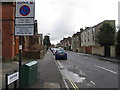
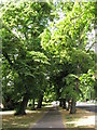
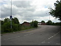
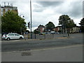


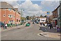
100 photos from this area
Area Information
Key information about the SO17 1DN including its size, population, and administrative classification.
- Area Type
- Postcode
- Area Size
- 1.5 hectares
- Population
- 2114
- Population Density
- 9583 people/km²
House Prices in SO17 1DN
62
Properties
£651,686
Average Sold Price
£438,000
Lowest Price
£900,000
Highest Price
Showing 62 properties
| Address | Type | Beds | Baths | Last Sale Price | Last Sale Date | |
|---|---|---|---|---|---|---|
| Greensleeves Rest Home, 8 Westwood Road, Southampton, SO17 1DN | hospital_care_home | - | - | £900,000 | May 2022 | |
| Harefield Lodge Care Home, 6 Westwood Road, Southampton, SO17 1DN | primary_healthcare | - | - | £698,745 | Mar 2015 | |
| 30 Westwood Road, Southampton, SO17 1DN | Flat | - | 1 | £570,000 | Aug 2013 | |
| 14 Westwood Road, Southampton, SO17 1DN | Detached | 11 | - | £438,000 | Jul 2001 | |
| Flat 5, Cranleigh House, 28 Westwood Road, Southampton, SO17 1DN | Flat | 1 | 1 | - | - | |
| Flat 6, Cranleigh House, 28 Westwood Road, Southampton, SO17 1DN | Flat | 1 | 1 | - | - | |
| Flat 2, Glenmore Court, 12 Westwood Road, Southampton, SO17 1DN | Flat | 2 | 2 | - | - | |
| Flat 12, Glenmore Court, 12 Westwood Road, Southampton, SO17 1DN | Flat | 2 | - | - | - | |
| Flat 9, 26 Westwood Road, Southampton, SO17 1DN | Flat | - | 1 | - | - | |
| Flat 14, 26 Westwood Road, Southampton, SO17 1DN | Flat | 1 | 1 | - | - |
Page 1 of 7
Energy Efficiency in SO17 1DN
Amenities
Schools
| Rank | School | Type | Entry gender | Ages |
|---|
Explore more schools in this area
Go to Schools tabDemographics
Household Size
One person
most common
Accommodation Type
Flats
most common
Tenure
27
majority
Ethnic Group
White
most common
Religion
N/A
most common
Household Composition
N/A
most common
Age
22
median
Young Adults (15-29 years)
most common
Household Deprivation
N/A
with no deprivation
NS-SEC
30
in Lower managerial occupations
Explore more demographic insights in this area
Go to Demographics tabPlanning
Planning Constraints
- Flood RiskPremium
- Ramsar Wetland SitesPremium
- Area of Outstanding Natural BeautyPremium
- Protected Nature ReservePremium
- Protected WoodlandPremium