Area Overview for SO16 8FX
Photos of SO16 8FX
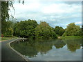
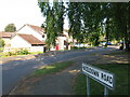
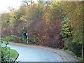
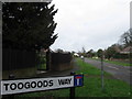
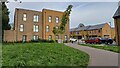

32 photos from this area
Area Information
Key information about the SO16 8FX including its size, population, and administrative classification.
- Area Type
- Postcode
- Area Size
- 2.2 hectares
- Population
- 1394
- Population Density
- 4222 people/km²
House Prices in SO16 8FX
38
Properties
£146,436
Average Sold Price
£41,000
Lowest Price
£245,250
Highest Price
Showing 38 properties
| Address | Type | Beds | Baths | Last Sale Price | Last Sale Date | |
|---|---|---|---|---|---|---|
| 3 Menzies Close, Southampton, SO16 8FX | house | 3 | 1 | £245,250 | Jul 2024 | |
| 28 Menzies Close, Southampton, SO16 8FX | house | - | - | £150,000 | Aug 2023 | |
| 4 Menzies Close, Southampton, SO16 8FX | Terraced | 3 | 2 | £230,000 | Apr 2023 | |
| 33 Menzies Close, Southampton, SO16 8FX | house | - | - | £198,000 | Apr 2022 | |
| 14 Menzies Close, Southampton, SO16 8FX | Terraced | 3 | 1 | £175,000 | Jan 2020 | |
| 12 Menzies Close, Southampton, SO16 8FX | Terraced | 3 | 1 | £200,000 | Jan 2020 | |
| 6 Menzies Close, Southampton, SO16 8FX | house | 3 | 1 | £210,000 | Nov 2019 | |
| 36 Menzies Close, Southampton, SO16 8FX | house | 3 | - | £180,000 | Nov 2019 | |
| 17 Menzies Close, Southampton, SO16 8FX | house | - | - | £163,000 | Sep 2019 | |
| 25 Menzies Close, Southampton, SO16 8FX | house | 3 | 1 | £135,000 | Nov 2018 |
Page 1 of 4
Energy Efficiency in SO16 8FX
Amenities
Schools
| Rank | School | Type | Entry gender | Ages |
|---|
Explore more schools in this area
Go to Schools tabDemographics
Household Size
Family (3-5 people)
most common
Accommodation Type
Houses
most common
Tenure
51
majority
Ethnic Group
White
most common
Religion
N/A
most common
Household Composition
N/A
most common
Age
47
median
Adults (30-64 years)
most common
Household Deprivation
N/A
with no deprivation
NS-SEC
19
in Lower managerial occupations
Explore more demographic insights in this area
Go to Demographics tabPlanning
Planning Constraints
- Flood RiskPremium
- Ramsar Wetland SitesPremium
- Area of Outstanding Natural BeautyPremium
- Protected Nature ReservePremium
- Protected WoodlandPremium