Area Overview for SO16 8FQ
Photos of SO16 8FQ
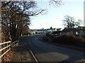
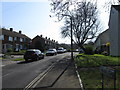
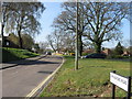
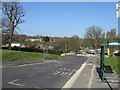
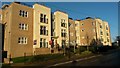
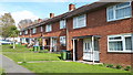
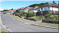
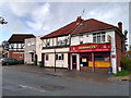
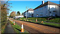
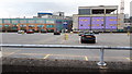
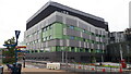
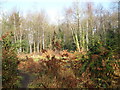
23 photos from this area
Area Information
Key information about the SO16 8FQ including its size, population, and administrative classification.
- Area Type
- Postcode
- Area Size
- 1.9 hectares
- Population
- 1697
- Population Density
- 4239 people/km²
House Prices in SO16 8FQ
60
Properties
£139,932
Average Sold Price
£47,000
Lowest Price
£285,000
Highest Price
Showing 60 properties
| Address | Type | Beds | Baths | Last Sale Price | Last Sale Date | |
|---|---|---|---|---|---|---|
| 43 Abercrombie Gardens, Southampton, SO16 8FQ | Flat | 1 | 1 | £75,000 | Aug 2025 | |
| 23 Abercrombie Gardens, Southampton, SO16 8FQ | Terraced | 3 | 1 | £265,000 | Feb 2025 | |
| 49 Abercrombie Gardens, Southampton, SO16 8FQ | Flat | - | - | £120,400 | Nov 2024 | |
| 45 Abercrombie Gardens, Southampton, SO16 8FQ | Flat | 1 | 1 | £121,000 | Jun 2024 | |
| 24 Abercrombie Gardens, Southampton, SO16 8FQ | house | 2 | 1 | £285,000 | Aug 2023 | |
| 31 Abercrombie Gardens, Southampton, SO16 8FQ | Flat | - | - | £116,000 | Jul 2023 | |
| 35 Abercrombie Gardens, Southampton, SO16 8FQ | Flat | - | - | £118,000 | Jun 2023 | |
| 1 Abercrombie Gardens, Southampton, SO16 8FQ | Terraced | 3 | 1 | £235,000 | Mar 2022 | |
| 18 Abercrombie Gardens, Southampton, SO16 8FQ | house | - | - | £240,500 | Jun 2021 | |
| 33 Abercrombie Gardens, Southampton, SO16 8FQ | Flat | - | - | £116,000 | Dec 2019 |
Page 1 of 6
Energy Efficiency in SO16 8FQ
Amenities
Schools
| Rank | School | Type | Entry gender | Ages |
|---|
Explore more schools in this area
Go to Schools tabDemographics
Household Size
Two person
most common
Accommodation Type
Houses
most common
Tenure
55
majority
Ethnic Group
White
most common
Religion
N/A
most common
Household Composition
N/A
most common
Age
47
median
Adults (30-64 years)
most common
Household Deprivation
N/A
with no deprivation
NS-SEC
35
in Lower managerial occupations
Explore more demographic insights in this area
Go to Demographics tabPlanning
Planning Constraints
- Flood RiskPremium
- Ramsar Wetland SitesPremium
- Area of Outstanding Natural BeautyPremium
- Protected Nature ReservePremium