Area Overview for SO16 8EE
Photos of SO16 8EE
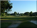
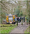
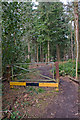
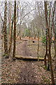
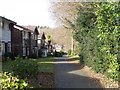
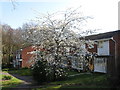
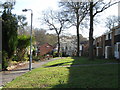
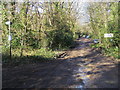
24 photos from this area
Area Information
Key information about the SO16 8EE including its size, population, and administrative classification.
- Area Type
- Postcode
- Area Size
- 2.8 hectares
- Population
- 1729
- Population Density
- 5588 people/km²
House Prices in SO16 8EE
45
Properties
£198,661
Average Sold Price
£23,500
Lowest Price
£318,500
Highest Price
Showing 45 properties
| Address | Type | Beds | Baths | Last Sale Price | Last Sale Date | |
|---|---|---|---|---|---|---|
| 20 Petworth Gardens, Southampton, SO16 8EE | Terraced | 3 | 1 | £260,000 | Oct 2025 | |
| 24 Petworth Gardens, Southampton, SO16 8EE | Terraced | 3 | 1 | £284,500 | Mar 2025 | |
| 21 Petworth Gardens, Southampton, SO16 8EE | Terraced | 3 | 1 | £310,000 | Jun 2024 | |
| 38 Petworth Gardens, Southampton, SO16 8EE | Terraced | 3 | 1 | £201,500 | Mar 2024 | |
| 2 Petworth Gardens, Southampton, SO16 8EE | Semi-detached | 3 | 1 | £318,500 | Feb 2024 | |
| 16 Petworth Gardens, Southampton, SO16 8EE | Terraced | 3 | 1 | £295,000 | Nov 2023 | |
| 31 Petworth Gardens, Southampton, SO16 8EE | Terraced | 3 | 1 | £282,500 | Aug 2023 | |
| 23 Petworth Gardens, Southampton, SO16 8EE | Terraced | 3 | 1 | £270,000 | Apr 2023 | |
| 26 Petworth Gardens, Southampton, SO16 8EE | house | 4 | - | £145,000 | Jan 2023 | |
| 30 Petworth Gardens, Southampton, SO16 8EE | Terraced | 3 | 1 | £239,000 | Jul 2021 |
Page 1 of 5
Energy Efficiency in SO16 8EE
Amenities
Schools
| Rank | School | Type | Entry gender | Ages |
|---|
Explore more schools in this area
Go to Schools tabDemographics
Household Size
Family (3-5 people)
most common
Accommodation Type
Houses
most common
Tenure
53
majority
Ethnic Group
White
most common
Religion
N/A
most common
Household Composition
N/A
most common
Age
47
median
Adults (30-64 years)
most common
Household Deprivation
N/A
with no deprivation
NS-SEC
27
in Lower managerial occupations
Explore more demographic insights in this area
Go to Demographics tabPlanning
Planning Constraints
- Flood RiskPremium
- Ramsar Wetland SitesPremium
- Area of Outstanding Natural BeautyPremium
- Protected Nature ReservePremium
- Protected WoodlandPremium