Area Overview for SO16 7PR
Photos of SO16 7PR


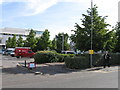


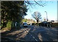
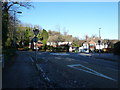
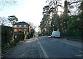
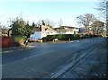
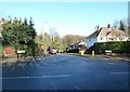
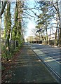
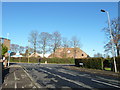
100 photos from this area
Area Information
Key information about the SO16 7PR including its size, population, and administrative classification.
- Area Type
- Postcode
- Area Size
- 4318 m²
- Population
- 2723
- Population Density
- 2410 people/km²
House Prices in SO16 7PR
9
Properties
£282,779
Average Sold Price
£113,500
Lowest Price
£500,000
Highest Price
Showing 9 properties
| Address | Type | Beds | Baths | Last Sale Price | Last Sale Date | |
|---|---|---|---|---|---|---|
| 185 Burgess Road, Southampton, SO16 7PR | Detached | 3 | 1 | £500,000 | Apr 2025 | |
| 195 Burgess Road, Southampton, SO16 7PR | Detached | 4 | 1 | £321,000 | Sep 2018 | |
| 189 Burgess Road, Southampton, SO16 7PR | house | 3 | - | £325,000 | Oct 2013 | |
| 193 Burgess Road, Southampton, SO16 7PR | Detached | 6 | 2 | £315,000 | Feb 2011 | |
| 183 Burgess Road, Southampton, SO16 7PR | Detached | - | - | £179,950 | Jul 2001 | |
| 181 Burgess Road, Southampton, SO16 7PR | Detached | 6 | 2 | £225,000 | Sep 2000 | |
| 191 Burgess Road, Southampton, SO16 7PR | Detached | - | - | £113,500 | Jul 1997 | |
| First Floor Flat, 187B Burgess Road, Southampton, SO16 7PR | Flat | - | - | - | - | |
| 187 Burgess Road, Southampton, SO16 7PR | Detached | 8 | 2 | - | - |
Energy Efficiency in SO16 7PR
Amenities
Schools
| Rank | School | Type | Entry gender | Ages |
|---|
Explore more schools in this area
Go to Schools tabDemographics
Household Size
Two person
most common
Accommodation Type
Houses
most common
Tenure
73
majority
Ethnic Group
White
most common
Religion
N/A
most common
Household Composition
N/A
most common
Age
22
median
Young Adults (15-29 years)
most common
Household Deprivation
N/A
with no deprivation
NS-SEC
28
in Lower managerial occupations
Explore more demographic insights in this area
Go to Demographics tabPlanning
Planning Constraints
- Flood RiskPremium
- Ramsar Wetland SitesPremium
- Area of Outstanding Natural BeautyPremium
- Protected Nature ReservePremium
- Protected WoodlandPremium