Area Overview for SO16 7LB
Photos of SO16 7LB
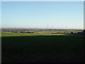
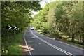
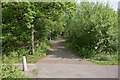
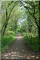
20 photos from this area
Area Information
Key information about the SO16 7LB including its size, population, and administrative classification.
- Area Type
- Postcode
- Area Size
- 51.4 hectares
- Population
- 1819
- Population Density
- 118 people/km²
House Prices in SO16 7LB
20
Properties
£1,090,179
Average Sold Price
£180,000
Lowest Price
£1,860,000
Highest Price
Showing 20 properties
| Address | Type | Beds | Baths | Last Sale Price | Last Sale Date | |
|---|---|---|---|---|---|---|
| The Garden House, Woodside, Chilworth, SO16 7LB | Detached | 5 | 5 | £1,150,000 | Aug 2021 | |
| 3, Treetops, Woodside, Chilworth, SO16 7LB | house | 6 | - | £1,750,000 | Jun 2021 | |
| Kilbracken, Woodside, Chilworth, SO16 7LB | house | - | - | £1,325,000 | Mar 2021 | |
| The Mulberry, Woodside, Chilworth, SO16 7LB | Detached | 5 | - | £1,250,000 | Sep 2020 | |
| The Winters, Woodside, Chilworth, SO16 7LB | Detached | 5 | 4 | £640,000 | May 2016 | |
| The Glade, Woodside, Chilworth, SO16 7LB | Detached | 5 | 4 | £1,850,000 | Apr 2015 | |
| Springwood, Woodside, Chilworth, SO16 7LB | house | 5 | - | £1,860,000 | Sep 2012 | |
| Blue Cedars, Woodside, Chilworth, SO16 7LB | Detached | 5 | 2 | £695,000 | Oct 2011 | |
| 2, Treetops, Woodside, Chilworth, SO16 7LB | house | 5 | - | £1,000,000 | Apr 2009 | |
| 1, Treetops, Woodside, Chilworth, SO16 7LB | Detached | 5 | 5 | £1,400,000 | Jan 2008 |
Page 1 of 2
Energy Efficiency in SO16 7LB
Amenities
Schools
| Rank | School | Type | Entry gender | Ages |
|---|
Explore more schools in this area
Go to Schools tabDemographics
Household Size
Two person
most common
Accommodation Type
Houses
most common
Tenure
86
majority
Ethnic Group
White
most common
Religion
N/A
most common
Household Composition
N/A
most common
Age
47
median
Adults (30-64 years)
most common
Household Deprivation
N/A
with no deprivation
NS-SEC
45
in Lower managerial occupations
Explore more demographic insights in this area
Go to Demographics tabPlanning
Planning Constraints
- Flood RiskPremium
- Ramsar Wetland SitesPremium
- Area of Outstanding Natural BeautyPremium
- Protected Nature ReservePremium
- Protected WoodlandPremium