Area Overview for SO16 7JS
Photos of SO16 7JS
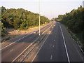
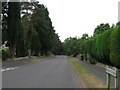
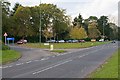
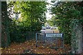
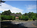


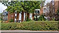
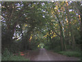

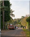
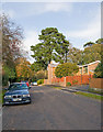
39 photos from this area
Area Information
Key information about the SO16 7JS including its size, population, and administrative classification.
- Area Type
- Postcode
- Area Size
- 4.2 hectares
- Population
- 1819
- Population Density
- 118 people/km²
House Prices in SO16 7JS
19
Properties
£804,214
Average Sold Price
£223,500
Lowest Price
£1,700,000
Highest Price
Showing 19 properties
| Address | Type | Beds | Baths | Last Sale Price | Last Sale Date | |
|---|---|---|---|---|---|---|
| Oakview, Chilworth Road, Chilworth, SO16 7JS | house | - | - | £1,700,000 | Jun 2023 | |
| Wealden, Chilworth Road, Chilworth, SO16 7JS | house | - | - | £925,000 | Sep 2020 | |
| Lynwood, Chilworth Road, Chilworth, SO16 7JS | house | 6 | - | £750,000 | Jul 2017 | |
| Nanak Nivas, Chilworth Road, Chilworth, SO16 7JS | house | - | - | £560,000 | Jul 2008 | |
| White Oaks, Chilworth Road, Chilworth, SO16 7JS | Detached | - | - | £871,000 | Aug 2001 | |
| Aloha, Chilworth Road, Chilworth, SO16 7JS | Detached | - | - | £600,000 | Oct 2000 | |
| Three Gables, Chilworth Road, Chilworth, SO16 7JS | Detached | - | - | £223,500 | Jul 1995 | |
| The Flat, White Oaks, Chilworth Road, Chilworth, SO16 7JS | undefined | - | - | - | - | |
| Indalo, Chilworth Road, Chilworth, SO16 7JS | Detached | - | - | - | - | |
| 1, Indalo Mews, Chilworth Road, Chilworth, SO16 7JS | Bungalow | - | - | - | - |
Page 1 of 2
Energy Efficiency in SO16 7JS
Amenities
Schools
| Rank | School | Type | Entry gender | Ages |
|---|
Explore more schools in this area
Go to Schools tabDemographics
Household Size
Two person
most common
Accommodation Type
Houses
most common
Tenure
86
majority
Ethnic Group
White
most common
Religion
N/A
most common
Household Composition
N/A
most common
Age
47
median
Adults (30-64 years)
most common
Household Deprivation
N/A
with no deprivation
NS-SEC
45
in Lower managerial occupations
Explore more demographic insights in this area
Go to Demographics tabPlanning
Planning Constraints
- Flood RiskPremium
- Ramsar Wetland SitesPremium
- Area of Outstanding Natural BeautyPremium
- Protected Nature ReservePremium
- Protected WoodlandPremium