Area Overview for SO16 7HW
Photos of SO16 7HW
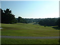
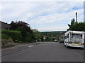
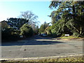
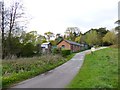

29 photos from this area
Area Information
Key information about the SO16 7HW including its size, population, and administrative classification.
- Area Type
- Postcode
- Area Size
- 3.0 hectares
- Population
- 1819
- Population Density
- 118 people/km²
House Prices in SO16 7HW
13
Properties
£707,500
Average Sold Price
£340,000
Lowest Price
£950,000
Highest Price
Showing 13 properties
| Address | Type | Beds | Baths | Last Sale Price | Last Sale Date | |
|---|---|---|---|---|---|---|
| Rowans, 6 The Ring, Chilworth, SO16 7HW | Detached | 4 | 3 | £950,000 | Jul 2022 | |
| Southerly, The Ring, Chilworth, SO16 7HW | house | - | - | £895,000 | May 2021 | |
| Bona Vista, The Ring, Chilworth, SO16 7HW | house | - | - | £705,000 | Jun 2018 | |
| Holly Hatch, The Ring, Chilworth, SO16 7HW | house | 5 | - | £705,000 | Jan 2012 | |
| Greenridge, The Ring, Chilworth, SO16 7HW | Detached | - | - | £650,000 | Aug 2002 | |
| Little Maples, The Ring, Chilworth, SO16 7HW | Detached | - | - | £340,000 | Jun 1999 | |
| Pinewood, The Ring, Chilworth, SO16 7HW | Detached | - | - | - | - | |
| Fern Court, The Ring, Chilworth, SO16 7HW | Detached | - | - | - | - | |
| Druids, 2 The Ring, Chilworth, SO16 7HW | Detached | - | - | - | - | |
| Midway, The Ring, Chilworth, SO16 7HW | Detached | - | - | - | - |
Page 1 of 2
Energy Efficiency in SO16 7HW
Amenities
Schools
| Rank | School | Type | Entry gender | Ages |
|---|
Explore more schools in this area
Go to Schools tabDemographics
Household Size
Two person
most common
Accommodation Type
Houses
most common
Tenure
86
majority
Ethnic Group
White
most common
Religion
N/A
most common
Household Composition
N/A
most common
Age
47
median
Adults (30-64 years)
most common
Household Deprivation
N/A
with no deprivation
NS-SEC
45
in Lower managerial occupations
Explore more demographic insights in this area
Go to Demographics tabPlanning
Planning Constraints
- Flood RiskPremium
- Ramsar Wetland SitesPremium
- Area of Outstanding Natural BeautyPremium
- Protected Nature ReservePremium
- Protected WoodlandPremium