Area Overview for SO16 7HF
Photos of SO16 7HF
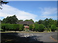


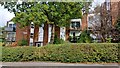
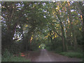
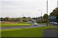
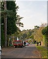
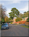
39 photos from this area
Area Information
Key information about the SO16 7HF including its size, population, and administrative classification.
- Area Type
- Postcode
- Area Size
- 2.6 hectares
- Population
- 1531
- Population Density
- 2361 people/km²
House Prices in SO16 7HF
17
Properties
£782,222
Average Sold Price
£189,000
Lowest Price
£1,450,000
Highest Price
Showing 17 properties
| Address | Type | Beds | Baths | Last Sale Price | Last Sale Date | |
|---|---|---|---|---|---|---|
| Oakleigh, Pine Way, Southampton, SO16 7HF | house | - | - | £1,250,000 | Jun 2023 | |
| Keepers House, Pine Way, Southampton, SO16 7HF | Detached | 7 | 6 | £1,450,000 | Oct 2018 | |
| Mirabelle St Dominics, Pine Way, Southampton, SO16 7HF | Detached | 5 | 3 | £870,000 | Sep 2015 | |
| Willow Bank, Pine Way, Southampton, SO16 7HF | Detached | 5 | 4 | £925,000 | Sep 2015 | |
| Enitor, Pine Way, Southampton, SO16 7HF | Detached | 4 | - | £541,000 | Aug 2014 | |
| Leafy Pine, Pine Way, Southampton, SO16 7HF | house | - | - | £850,000 | Feb 2011 | |
| Pinelands House, Pine Way, Southampton, SO16 7HF | Detached | 5 | - | £690,000 | Jan 2006 | |
| Wychwood, Pine Way, Southampton, SO16 7HF | house | - | - | £275,000 | Mar 1997 | |
| Boca Glades, Pine Way, Southampton, SO16 7HF | Detached | - | - | £189,000 | Apr 1996 | |
| Flat 2, Chilworth Lakes, Pine Way, Southampton, SO16 7HF | Flat | 6 | - | - | - |
Page 1 of 2
Energy Efficiency in SO16 7HF
Amenities
Schools
| Rank | School | Type | Entry gender | Ages |
|---|
Explore more schools in this area
Go to Schools tabDemographics
Household Size
Two person
most common
Accommodation Type
Houses
most common
Tenure
70
majority
Ethnic Group
White
most common
Religion
N/A
most common
Household Composition
N/A
most common
Age
47
median
Adults (30-64 years)
most common
Household Deprivation
N/A
with no deprivation
NS-SEC
48
in Lower managerial occupations
Explore more demographic insights in this area
Go to Demographics tabPlanning
Planning Constraints
- Flood RiskPremium
- Ramsar Wetland SitesPremium
- Area of Outstanding Natural BeautyPremium
- Protected Nature ReservePremium
- Protected WoodlandPremium