Area Overview for SO16 7AH
Photos of SO16 7AH
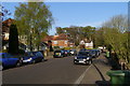
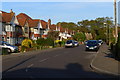
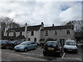
73 photos from this area
Area Information
Key information about the SO16 7AH including its size, population, and administrative classification.
- Area Type
- Postcode
- Area Size
- 28.1 hectares
- Population
- 1567
- Population Density
- 1802 people/km²
House Prices in SO16 7AH
15
Properties
£269,500
Average Sold Price
£170,000
Lowest Price
£390,000
Highest Price
Showing 15 properties
| Address | Type | Beds | Baths | Last Sale Price | Last Sale Date | |
|---|---|---|---|---|---|---|
| 24 Burgess Road, Southampton, SO16 7AH | Detached | 3 | 2 | £280,000 | Nov 2025 | |
| 26 Burgess Road, Southampton, SO16 7AH | Semi-detached | 4 | 2 | £375,000 | Nov 2025 | |
| 32 Burgess Road, Southampton, SO16 7AH | Semi-detached | 3 | 2 | £390,000 | Feb 2025 | |
| 36 Burgess Road, Southampton, SO16 7AH | Semi-detached | 3 | - | £293,500 | Nov 2021 | |
| 28 Burgess Road, Southampton, SO16 7AH | Semi-detached | 4 | 1 | £247,000 | Dec 2017 | |
| 40 Burgess Road, Southampton, SO16 7AH | Detached | 3 | 1 | £255,000 | Jun 2015 | |
| 30 Burgess Road, Southampton, SO16 7AH | house | - | - | £170,000 | Mar 2011 | |
| 34 Burgess Road, Southampton, SO16 7AH | Detached | 3 | 1 | £205,000 | Oct 2005 | |
| 18 Burgess Road, Southampton, SO16 7AH | Detached | 3 | 2 | £210,000 | Feb 2003 | |
| 40B Burgess Road, Southampton, SO16 7AH | house | 1 | 3 | - | - |
Page 1 of 2
Energy Efficiency in SO16 7AH
Amenities
Schools
| Rank | School | Type | Entry gender | Ages |
|---|
Explore more schools in this area
Go to Schools tabDemographics
Household Size
Family (3-5 people)
most common
Accommodation Type
Houses
most common
Tenure
79
majority
Ethnic Group
White
most common
Religion
N/A
most common
Household Composition
N/A
most common
Age
47
median
Adults (30-64 years)
most common
Household Deprivation
N/A
with no deprivation
NS-SEC
51
in Lower managerial occupations
Explore more demographic insights in this area
Go to Demographics tabPlanning
Planning Constraints
- Flood RiskPremium
- Ramsar Wetland SitesPremium
- Area of Outstanding Natural BeautyPremium
- Protected Nature ReservePremium
- Protected WoodlandPremium