Area Overview for SO16 6AL
Photos of SO16 6AL
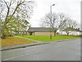

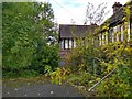
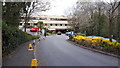
90 photos from this area
Area Information
Key information about the SO16 6AL including its size, population, and administrative classification.
- Area Type
- Postcode
- Area Size
- 1.2 hectares
- Population
- Not available
- Population Density
- Not available
House Prices in SO16 6AL
39
Properties
£187,917
Average Sold Price
£85,000
Lowest Price
£331,500
Highest Price
Showing 39 properties
| Address | Type | Beds | Baths | Last Sale Price | Last Sale Date | |
|---|---|---|---|---|---|---|
| 64 Jessamine Road, Southampton, SO16 6AL | Bungalow | 2 | 1 | £230,000 | Feb 2024 | |
| 22 Jessamine Road, Southampton, SO16 6AL | Semi-detached | 3 | 2 | £331,500 | Oct 2022 | |
| 72 Jessamine Road, Southampton, SO16 6AL | Bungalow | 3 | 1 | £300,000 | Oct 2022 | |
| 8 Jessamine Road, Southampton, SO16 6AL | Semi-detached | 1 | 1 | £290,000 | Nov 2018 | |
| 26 Jessamine Road, Southampton, SO16 6AL | house | 1 | - | £158,000 | Dec 2011 | |
| 24 Jessamine Road, Southampton, SO16 6AL | house | 2 | - | £150,000 | Nov 2011 | |
| 62 Jessamine Road, Southampton, SO16 6AL | Bungalow | 3 | - | £111,000 | Jun 2009 | |
| 68 Jessamine Road, Southampton, SO16 6AL | Bungalow | - | - | £140,000 | Jul 2008 | |
| 20 Jessamine Road, Southampton, SO16 6AL | Semi-detached | - | - | £162,000 | Mar 2007 | |
| 70 Jessamine Road, Southampton, SO16 6AL | Bungalow | - | - | £147,500 | Mar 2005 |
Page 1 of 4
Energy Efficiency in SO16 6AL
Amenities
Schools
| Rank | School | Type | Entry gender | Ages |
|---|
Explore more schools in this area
Go to Schools tabDemographics
Household Size
Family (3-5 people)
most common
Accommodation Type
Houses
most common
Tenure
33
majority
Ethnic Group
White
most common
Religion
N/A
most common
Household Composition
N/A
most common
Age
47
median
Adults (30-64 years)
most common
Household Deprivation
N/A
with no deprivation
NS-SEC
30
in Lower managerial occupations
Explore more demographic insights in this area
Go to Demographics tabPlanning
Planning Constraints
- Flood RiskPremium
- Ramsar Wetland SitesPremium
- Area of Outstanding Natural BeautyPremium
- Protected Nature ReservePremium
- Protected WoodlandPremium