Area Overview for SO16 5DZ
Photos of SO16 5DZ
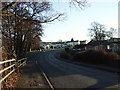
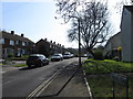
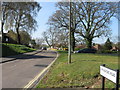
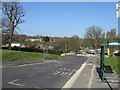
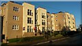
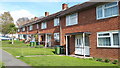
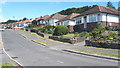
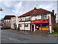
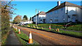
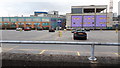
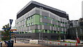
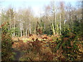
23 photos from this area
Area Information
Key information about the SO16 5DZ including its size, population, and administrative classification.
- Area Type
- Postcode
- Area Size
- 1.1 hectares
- Population
- 1715
- Population Density
- 7622 people/km²
House Prices in SO16 5DZ
36
Properties
£153,529
Average Sold Price
£41,000
Lowest Price
£255,000
Highest Price
Showing 36 properties
| Address | Type | Beds | Baths | Last Sale Price | Last Sale Date | |
|---|---|---|---|---|---|---|
| 17 Rowan Close, Southampton, SO16 5DZ | Semi-detached | 3 | 1 | £250,000 | Jan 2024 | |
| 19 Rowan Close, Southampton, SO16 5DZ | Semi-detached | 3 | 1 | £255,000 | Aug 2023 | |
| 25 Rowan Close, Southampton, SO16 5DZ | house | - | - | £200,000 | Sep 2021 | |
| 11 Rowan Close, Southampton, SO16 5DZ | Semi-detached | 3 | 1 | £235,000 | Jul 2019 | |
| 30 Rowan Close, Southampton, SO16 5DZ | Semi-detached | 3 | - | £167,000 | Sep 2013 | |
| 20 Rowan Close, Southampton, SO16 5DZ | Semi-detached | 3 | 1 | £150,000 | Jul 2013 | |
| 5 Rowan Close, Southampton, SO16 5DZ | Semi-detached | 3 | 1 | £130,000 | Jul 2012 | |
| 23 Rowan Close, Southampton, SO16 5DZ | house | - | - | £139,000 | Aug 2010 | |
| 16 Rowan Close, Southampton, SO16 5DZ | house | - | - | £131,000 | Mar 2009 | |
| 21 Rowan Close, Southampton, SO16 5DZ | house | - | - | £163,000 | Sep 2008 |
Page 1 of 4
Energy Efficiency in SO16 5DZ
Amenities
Schools
| Rank | School | Type | Entry gender | Ages |
|---|
Explore more schools in this area
Go to Schools tabDemographics
Household Size
Family (3-5 people)
most common
Accommodation Type
Houses
most common
Tenure
76
majority
Ethnic Group
White
most common
Religion
N/A
most common
Household Composition
N/A
most common
Age
47
median
Adults (30-64 years)
most common
Household Deprivation
N/A
with no deprivation
NS-SEC
29
in Lower managerial occupations
Explore more demographic insights in this area
Go to Demographics tabPlanning
Planning Constraints
- Flood RiskPremium
- Ramsar Wetland SitesPremium
- Area of Outstanding Natural BeautyPremium
- Protected Nature ReservePremium
- Protected WoodlandPremium