Area Overview for SO16 4FE
Photos of SO16 4FE


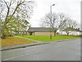

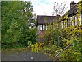

90 photos from this area
Area Information
Key information about the SO16 4FE including its size, population, and administrative classification.
- Area Type
- Postcode
- Area Size
- 1.0 hectares
- Population
- 1678
- Population Density
- 7941 people/km²
House Prices in SO16 4FE
35
Properties
£145,190
Average Sold Price
£66,950
Lowest Price
£220,000
Highest Price
Showing 35 properties
| Address | Type | Beds | Baths | Last Sale Price | Last Sale Date | |
|---|---|---|---|---|---|---|
| 53 Broughton Close, Southampton, SO16 4FE | Terraced | 2 | 1 | £220,000 | May 2023 | |
| 54 Broughton Close, Southampton, SO16 4FE | house | - | - | £176,000 | Jan 2018 | |
| 56 Broughton Close, Southampton, SO16 4FE | house | - | - | £120,000 | Apr 2014 | |
| 58 Broughton Close, Southampton, SO16 4FE | Terraced | - | - | £143,000 | May 2007 | |
| 57 Broughton Close, Southampton, SO16 4FE | house | - | - | £66,950 | May 2001 | |
| 55 Broughton Close, Southampton, SO16 4FE | Terraced | 2 | 1 | - | - | |
| Flat 25, Maybush Court, Broughton Close, Southampton, SO16 4FE | Flat | 1 | 1 | - | - | |
| Glass Bank Igloo In Car Park Opposite 25 To 26, Broughton Close, Southampton, SO16 4FE | commercial | - | - | - | - | |
| Flat 40, Maybush Court, Broughton Close, Southampton, SO16 4FE | Flat | - | - | - | - | |
| Flat 35, Maybush Court, Broughton Close, Southampton, SO16 4FE | Flat | - | - | - | - |
Page 1 of 4
Energy Efficiency in SO16 4FE
Amenities
Schools
| Rank | School | Type | Entry gender | Ages |
|---|
Explore more schools in this area
Go to Schools tabDemographics
Household Size
Family (3-5 people)
most common
Accommodation Type
Flats
most common
Tenure
22
majority
Ethnic Group
White
most common
Religion
N/A
most common
Household Composition
N/A
most common
Age
47
median
Adults (30-64 years)
most common
Household Deprivation
N/A
with no deprivation
NS-SEC
15
in Lower managerial occupations
Explore more demographic insights in this area
Go to Demographics tabPlanning
Planning Constraints
- Flood RiskPremium
- Ramsar Wetland SitesPremium
- Area of Outstanding Natural BeautyPremium
- Protected Nature ReservePremium
- Protected WoodlandPremium