Area Overview for SO15 5RZ
Photos of SO15 5RZ

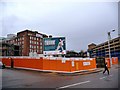
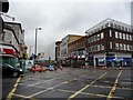
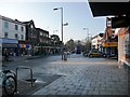
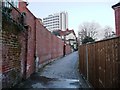

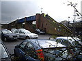

100 photos from this area
Area Information
Key information about the SO15 5RZ including its size, population, and administrative classification.
- Area Type
- Postcode
- Area Size
- 1.8 hectares
- Population
- 2074
- Population Density
- 1576 people/km²
House Prices in SO15 5RZ
59
Properties
£182,324
Average Sold Price
£55,000
Lowest Price
£280,000
Highest Price
Showing 59 properties
| Address | Type | Beds | Baths | Last Sale Price | Last Sale Date | |
|---|---|---|---|---|---|---|
| 39 Mandela Way, Southampton, SO15 5RZ | house | - | - | £280,000 | Feb 2024 | |
| 6 Mandela Way, Southampton, SO15 5RZ | Semi-detached | 2 | - | £225,000 | Feb 2020 | |
| 40 Mandela Way, Southampton, SO15 5RZ | Terraced | 3 | 1 | £210,000 | Oct 2019 | |
| 11 Mandela Way, Southampton, SO15 5RZ | Terraced | 3 | 1 | £203,000 | Nov 2018 | |
| 45 Mandela Way, Southampton, SO15 5RZ | Terraced | 1 | 1 | £155,000 | Sep 2016 | |
| 44 Mandela Way, Southampton, SO15 5RZ | Terraced | 1 | - | £156,000 | May 2016 | |
| 13 Mandela Way, Southampton, SO15 5RZ | Terraced | 3 | 1 | £205,000 | Nov 2015 | |
| 27 Mandela Way, Southampton, SO15 5RZ | Terraced | 4 | 1 | £218,500 | Jun 2015 | |
| 47, Devon Mews, Mandela Way, Southampton, SO15 5RZ | Semi-detached | 3 | - | £222,500 | Mar 2014 | |
| 5 Mandela Way, Southampton, SO15 5RZ | Terraced | 3 | 1 | £175,000 | Oct 2013 |
Page 1 of 6
Energy Efficiency in SO15 5RZ
Amenities
Schools
| Rank | School | Type | Entry gender | Ages |
|---|
Explore more schools in this area
Go to Schools tabDemographics
Household Size
One person
most common
Accommodation Type
Flats
most common
Tenure
31
majority
Ethnic Group
White
most common
Religion
N/A
most common
Household Composition
N/A
most common
Age
47
median
Adults (30-64 years)
most common
Household Deprivation
N/A
with no deprivation
NS-SEC
29
in Lower managerial occupations
Explore more demographic insights in this area
Go to Demographics tabPlanning
Planning Constraints
- Flood RiskPremium
- Ramsar Wetland SitesPremium
- Area of Outstanding Natural BeautyPremium
- Protected Nature ReservePremium
- Protected WoodlandPremium