Area Overview for SO15 5FP
Photos of SO15 5FP
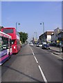
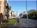
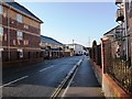
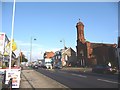
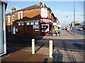

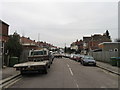
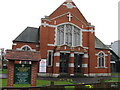
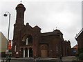
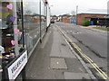
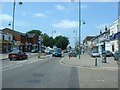
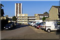
100 photos from this area
Area Information
Key information about the SO15 5FP including its size, population, and administrative classification.
- Area Type
- Postcode
- Area Size
- 1.9 hectares
- Population
- 2041
- Population Density
- 8824 people/km²
House Prices in SO15 5FP
47
Properties
£213,423
Average Sold Price
£50,750
Lowest Price
£354,000
Highest Price
Showing 47 properties
| Address | Type | Beds | Baths | Last Sale Price | Last Sale Date | |
|---|---|---|---|---|---|---|
| 87 Malmesbury Road, Southampton, SO15 5FP | Terraced | 3 | 1 | £275,000 | Oct 2025 | |
| 89 Malmesbury Road, Southampton, SO15 5FP | Terraced | 3 | 3 | £280,000 | Jun 2025 | |
| 67 Malmesbury Road, Southampton, SO15 5FP | Flat | 1 | 1 | £140,000 | Nov 2024 | |
| 61 Malmesbury Road, Southampton, SO15 5FP | Terraced | 3 | 1 | £278,000 | Nov 2024 | |
| 57 Malmesbury Road, Southampton, SO15 5FP | Terraced | 3 | 1 | £253,000 | Mar 2024 | |
| 75 Malmesbury Road, Southampton, SO15 5FP | Terraced | 3 | 1 | £242,580 | Dec 2023 | |
| 105 Malmesbury Road, Southampton, SO15 5FP | Terraced | 3 | - | £350,000 | Oct 2023 | |
| 109 Malmesbury Road, Southampton, SO15 5FP | Terraced | 3 | 1 | £354,000 | Dec 2022 | |
| 41 Malmesbury Road, Southampton, SO15 5FP | Semi-detached | 1 | 1 | £285,000 | Aug 2022 | |
| 115 Malmesbury Road, Southampton, SO15 5FP | Terraced | 3 | 1 | £345,000 | Jul 2022 |
Page 1 of 5
Energy Efficiency in SO15 5FP
Amenities
Schools
| Rank | School | Type | Entry gender | Ages |
|---|
Explore more schools in this area
Go to Schools tabDemographics
Household Size
One person
most common
Accommodation Type
Houses
most common
Tenure
44
majority
Ethnic Group
White
most common
Religion
N/A
most common
Household Composition
N/A
most common
Age
47
median
Adults (30-64 years)
most common
Household Deprivation
N/A
with no deprivation
NS-SEC
30
in Lower managerial occupations
Explore more demographic insights in this area
Go to Demographics tabPlanning
Planning Constraints
- Flood RiskPremium
- Ramsar Wetland SitesPremium
- Area of Outstanding Natural BeautyPremium
- Protected Nature ReservePremium
- Protected WoodlandPremium