Area Overview for SO15 5AN
Photos of SO15 5AN
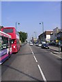
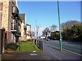
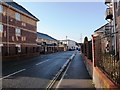

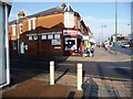

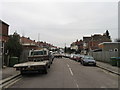


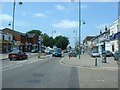
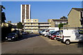
100 photos from this area
Area Information
Key information about the SO15 5AN including its size, population, and administrative classification.
- Area Type
- Postcode
- Area Size
- 5762 m²
- Population
- 1321
- Population Density
- 229279 people/km²
House Prices in SO15 5AN
18
Properties
£339,479
Average Sold Price
£103,000
Lowest Price
£625,000
Highest Price
Showing 18 properties
| Address | Type | Beds | Baths | Last Sale Price | Last Sale Date | |
|---|---|---|---|---|---|---|
| 14 Hanley Road, Southampton, SO15 5AN | house | 5 | 2 | £625,000 | Mar 2025 | |
| 4 Hanley Road, Southampton, SO15 5AN | Terraced | 4 | 1 | £432,950 | Feb 2024 | |
| 26 Hanley Road, Southampton, SO15 5AN | house | - | - | £492,500 | Dec 2018 | |
| 24 Hanley Road, Southampton, SO15 5AN | house | - | - | £420,000 | Jul 2017 | |
| 8 Hanley Road, Southampton, SO15 5AN | Semi-detached | 4 | - | £465,000 | Feb 2017 | |
| 30 Hanley Road, Southampton, SO15 5AN | house | - | - | £375,000 | Oct 2014 | |
| 20 Hanley Road, Southampton, SO15 5AN | Detached | 5 | - | £450,000 | Feb 2014 | |
| 28 Hanley Road, Southampton, SO15 5AN | house | 4 | - | £350,000 | Aug 2012 | |
| 22 Hanley Road, Southampton, SO15 5AN | Detached | - | - | £305,000 | May 2006 | |
| 10 Hanley Road, Southampton, SO15 5AN | Semi-detached | - | - | £310,000 | Apr 2005 |
Page 1 of 2
Energy Efficiency in SO15 5AN
Amenities
Schools
| Rank | School | Type | Entry gender | Ages |
|---|
Explore more schools in this area
Go to Schools tabDemographics
Household Size
Family (3-5 people)
most common
Accommodation Type
Houses
most common
Tenure
89
majority
Ethnic Group
White
most common
Religion
N/A
most common
Household Composition
N/A
most common
Age
47
median
Adults (30-64 years)
most common
Household Deprivation
N/A
with no deprivation
NS-SEC
52
in Lower managerial occupations
Explore more demographic insights in this area
Go to Demographics tabPlanning
Planning Constraints
- Flood RiskPremium
- Ramsar Wetland SitesPremium
- Area of Outstanding Natural BeautyPremium
- Protected Nature ReservePremium
- Protected WoodlandPremium