Area Overview for SO15 3BY
Photos of SO15 3BY
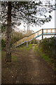
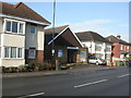
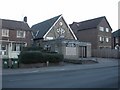
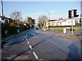
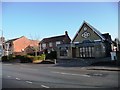
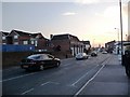
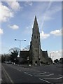
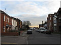
100 photos from this area
Area Information
Key information about the SO15 3BY including its size, population, and administrative classification.
- Area Type
- Postcode
- Area Size
- 6676 m²
- Population
- 1942
- Population Density
- 7267 people/km²
House Prices in SO15 3BY
21
Properties
£158,777
Average Sold Price
£41,000
Lowest Price
£320,000
Highest Price
Showing 21 properties
| Address | Type | Beds | Baths | Last Sale Price | Last Sale Date | |
|---|---|---|---|---|---|---|
| 54 Paynes Road, Southampton, SO15 3BY | Terraced | 2 | 1 | £233,950 | Mar 2025 | |
| 64 Paynes Road, Southampton, SO15 3BY | house | 2 | 2 | £200,000 | Aug 2023 | |
| 66 Paynes Road, Southampton, SO15 3BY | Retail | 2 | 1 | £248,000 | Jun 2022 | |
| 80 Paynes Road, Southampton, SO15 3BY | house | - | - | £320,000 | Jan 2022 | |
| 58 Paynes Road, Southampton, SO15 3BY | Terraced | 2 | 1 | £214,000 | Oct 2021 | |
| 72 Paynes Road, Southampton, SO15 3BY | Detached | 3 | 1 | £230,000 | Mar 2011 | |
| 78 Paynes Road, Southampton, SO15 3BY | Semi-detached | - | - | £169,950 | Nov 2007 | |
| 74 Paynes Road, Southampton, SO15 3BY | Semi-detached | 3 | 1 | £176,500 | Aug 2007 | |
| 56 Paynes Road, Southampton, SO15 3BY | Terraced | - | - | £88,250 | Oct 2001 | |
| 50 Paynes Road, Southampton, SO15 3BY | house | - | - | £43,000 | Jul 1998 |
Page 1 of 3
Energy Efficiency in SO15 3BY
Amenities
Schools
| Rank | School | Type | Entry gender | Ages |
|---|
Explore more schools in this area
Go to Schools tabDemographics
Household Size
One person
most common
Accommodation Type
Flats
most common
Tenure
42
majority
Ethnic Group
White
most common
Religion
N/A
most common
Household Composition
N/A
most common
Age
47
median
Adults (30-64 years)
most common
Household Deprivation
N/A
with no deprivation
NS-SEC
30
in Lower managerial occupations
Explore more demographic insights in this area
Go to Demographics tabPlanning
Planning Constraints
- Flood RiskPremium
- Ramsar Wetland SitesPremium
- Area of Outstanding Natural BeautyPremium
- Protected Nature ReservePremium
- Protected WoodlandPremium