Area Overview for SO15 2JA
Photos of SO15 2JA

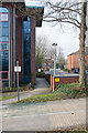
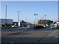
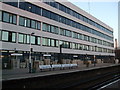
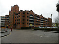
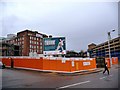
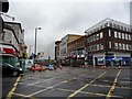
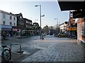
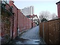


100 photos from this area
Area Information
Key information about the SO15 2JA including its size, population, and administrative classification.
- Area Type
- Postcode
- Area Size
- 2246 m²
- Population
- 2165
- Population Density
- 13169 people/km²
House Prices in SO15 2JA
14
Properties
£173,620
Average Sold Price
£25,000
Lowest Price
£297,500
Highest Price
Showing 14 properties
| Address | Type | Beds | Baths | Last Sale Price | Last Sale Date | |
|---|---|---|---|---|---|---|
| 109 Milton Road, Southampton, SO15 2JA | Terraced | 3 | 1 | £297,500 | Oct 2024 | |
| 121 Milton Road, Southampton, SO15 2JA | Terraced | 4 | 1 | £281,000 | Oct 2022 | |
| 113 Milton Road, Southampton, SO15 2JA | house | 1 | 1 | £280,000 | Dec 2018 | |
| 117 Milton Road, Southampton, SO15 2JA | Terraced | 3 | 1 | £180,000 | Apr 2016 | |
| 115 Milton Road, Southampton, SO15 2JA | Terraced | 5 | 1 | £205,000 | Jan 2015 | |
| 129A Milton Road, Southampton, SO15 2JA | Maisonette | - | - | £125,000 | May 2008 | |
| 107 Milton Road, Southampton, SO15 2JA | Terraced | 4 | 1 | £185,000 | Jul 2006 | |
| 119 Milton Road, Southampton, SO15 2JA | Terraced | 4 | 1 | £93,500 | Jan 2001 | |
| 125 Milton Road, Southampton, SO15 2JA | house | 3 | 1 | £64,200 | Jul 1998 | |
| 129 Milton Road, Southampton, SO15 2JA | Flat | - | - | £25,000 | Jun 1998 |
Page 1 of 2
Energy Efficiency in SO15 2JA
Amenities
Schools
| Rank | School | Type | Entry gender | Ages |
|---|
Explore more schools in this area
Go to Schools tabDemographics
Household Size
One person
most common
Accommodation Type
Flats
most common
Tenure
27
majority
Ethnic Group
White
most common
Religion
N/A
most common
Household Composition
N/A
most common
Age
22
median
Young Adults (15-29 years)
most common
Household Deprivation
N/A
with no deprivation
NS-SEC
29
in Lower managerial occupations
Explore more demographic insights in this area
Go to Demographics tabPlanning
Planning Constraints
- Flood RiskPremium
- Ramsar Wetland SitesPremium
- Area of Outstanding Natural BeautyPremium
- Protected Nature ReservePremium
- Protected WoodlandPremium