Area Overview for SO15 2FG
Photos of SO15 2FG

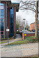
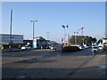
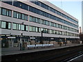
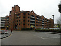


100 photos from this area
Area Information
Key information about the SO15 2FG including its size, population, and administrative classification.
- Area Type
- Postcode
- Area Size
- 2190 m²
- Population
- 1962
- Population Density
- 10326 people/km²
House Prices in SO15 2FG
12
Properties
£240,215
Average Sold Price
£179,000
Lowest Price
£285,000
Highest Price
Showing 12 properties
| Address | Type | Beds | Baths | Last Sale Price | Last Sale Date | |
|---|---|---|---|---|---|---|
| 10 Handel Terrace, Southampton, SO15 2FG | Terraced | 3 | 1 | £285,000 | Oct 2025 | |
| 3 Handel Terrace, Southampton, SO15 2FG | Terraced | 4 | 2 | £255,000 | Sep 2024 | |
| 2 Handel Terrace, Southampton, SO15 2FG | Terraced | 3 | 1 | £268,000 | Sep 2023 | |
| 9 Handel Terrace, Southampton, SO15 2FG | house | - | - | £217,500 | Jun 2023 | |
| 5 Handel Terrace, Southampton, SO15 2FG | Terraced | 4 | 1 | £271,650 | Apr 2023 | |
| 4 Handel Terrace, Southampton, SO15 2FG | Terraced | 3 | 1 | £230,000 | Feb 2020 | |
| 6 Handel Terrace, Southampton, SO15 2FG | Terraced | 1 | 1 | £275,000 | Dec 2017 | |
| 12 Handel Terrace, Southampton, SO15 2FG | Semi-detached | 3 | 3 | £230,000 | Nov 2016 | |
| 8 Handel Terrace, Southampton, SO15 2FG | Terraced | - | - | £191,000 | May 2014 | |
| 7 Handel Terrace, Southampton, SO15 2FG | Terraced | 3 | 1 | £179,000 | Dec 2009 |
Page 1 of 2
Energy Efficiency in SO15 2FG
Amenities
Schools
| Rank | School | Type | Entry gender | Ages |
|---|
Explore more schools in this area
Go to Schools tabDemographics
Household Size
One person
most common
Accommodation Type
Flats
most common
Tenure
30
majority
Ethnic Group
White
most common
Religion
N/A
most common
Household Composition
N/A
most common
Age
22
median
Young Adults (15-29 years)
most common
Household Deprivation
N/A
with no deprivation
NS-SEC
23
in Lower managerial occupations
Explore more demographic insights in this area
Go to Demographics tabPlanning
Planning Constraints
- Flood RiskPremium
- Ramsar Wetland SitesPremium
- Area of Outstanding Natural BeautyPremium
- Protected Nature ReservePremium
- Protected WoodlandPremium