Area Overview for SO15 2AT
Photos of SO15 2AT
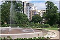


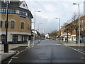
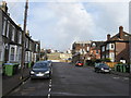
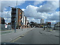

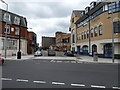
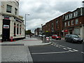
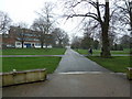
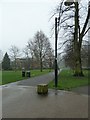
100 photos from this area
Area Information
Key information about the SO15 2AT including its size, population, and administrative classification.
- Area Type
- Postcode
- Area Size
- 5153 m²
- Population
- 1951
- Population Density
- 8816 people/km²
House Prices in SO15 2AT
8
Properties
£208,000
Average Sold Price
£208,000
Lowest Price
£208,000
Highest Price
Showing 8 properties
| Address | Type | Beds | Baths | Last Sale Price | Last Sale Date | |
|---|---|---|---|---|---|---|
| 15 Kings Park Road, Southampton, SO15 2AT | Semi-detached | 4 | 1 | £208,000 | Aug 2010 | |
| Transform Cosmetic Surgery Group, First Floor Lhs, Crown House 1, 18-21 Kings Park Road, Southampton, SO15 2AT | office_workshop | - | - | - | - | |
| Ceg Ufp Limited, Ground Floor, Crown House 1, 18-21 Kings Park Road, Southampton, SO15 2AT | office_workshop | - | - | - | - | |
| Craigard Limited, First Floor Rhs, Crown House 1, 18-21 Kings Park Road, Southampton, SO15 2AT | office_workshop | - | - | - | - | |
| Harcourts Property Agents, 11 Kings Park Road, Southampton, SO15 2AT | office_workshop | - | - | - | - | |
| 12-14 Kings Park Road, Southampton, SO15 2AT | house | - | - | - | - | |
| Aap3 Limited, Third Floor, Crown House 1, 18-21 Kings Park Road, Southampton, SO15 2AT | office_workshop | - | - | - | - | |
| The Works Staffing Solutions Limited, Ground Floor, Kings Park House, 22 Kings Park Road, Southampton, SO15 2AT | Office | - | - | - | - |
Energy Efficiency in SO15 2AT
Amenities
Schools
| Rank | School | Type | Entry gender | Ages |
|---|
Explore more schools in this area
Go to Schools tabDemographics
Household Size
One person
most common
Accommodation Type
Flats
most common
Tenure
15
majority
Ethnic Group
White
most common
Religion
N/A
most common
Household Composition
N/A
most common
Age
22
median
Young Adults (15-29 years)
most common
Household Deprivation
N/A
with no deprivation
NS-SEC
27
in Lower managerial occupations
Explore more demographic insights in this area
Go to Demographics tabPlanning
Planning Constraints
- Flood RiskPremium
- Ramsar Wetland SitesPremium
- Area of Outstanding Natural BeautyPremium
- Protected Nature ReservePremium
- Protected WoodlandPremium