Area Overview for SO14 3TQ
Photos of SO14 3TQ


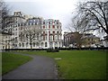
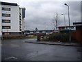

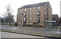
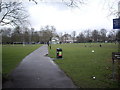
100 photos from this area
Area Information
Key information about the SO14 3TQ including its size, population, and administrative classification.
- Area Type
- Postcode
- Area Size
- 2429 m²
- Population
- 1797
- Population Density
- 15653 people/km²
House Prices in SO14 3TQ
30
Properties
£117,701
Average Sold Price
£44,000
Lowest Price
£155,000
Highest Price
Showing 30 properties
| Address | Type | Beds | Baths | Last Sale Price | Last Sale Date | |
|---|---|---|---|---|---|---|
| Flat 25, Commodore Court, Captains Place, Southampton, SO14 3TQ | Flat | 1 | 1 | £118,000 | Jan 2025 | |
| Flat 23, Commodore Court, Captains Place, Southampton, SO14 3TQ | Flat | - | - | £138,000 | Jun 2024 | |
| Flat 29, Commodore Court, Captains Place, Southampton, SO14 3TQ | Flat | - | - | £155,000 | Mar 2023 | |
| Flat 24, Commodore Court, Captains Place, Southampton, SO14 3TQ | Flat | - | - | £130,500 | Apr 2019 | |
| Flat 28, Commodore Court, Captains Place, Southampton, SO14 3TQ | Flat | 1 | 1 | £124,000 | Feb 2007 | |
| Flat 22, Commodore Court, Captains Place, Southampton, SO14 3TQ | Flat | 1 | 1 | £125,000 | Sep 2006 | |
| Flat 26, Commodore Court, Captains Place, Southampton, SO14 3TQ | Flat | - | - | £107,107 | Aug 2002 | |
| Flat 27, Commodore Court, Captains Place, Southampton, SO14 3TQ | Flat | 1 | 1 | £44,000 | Dec 1997 | |
| Flat 10, Commodore Court, Captains Place, Southampton, SO14 3TQ | Flat | 1 | 1 | - | - | |
| Flat 13, Commodore Court, Captains Place, Southampton, SO14 3TQ | Flat | 1 | 1 | - | - |
Page 1 of 3
Energy Efficiency in SO14 3TQ
Amenities
Schools
| Rank | School | Type | Entry gender | Ages |
|---|
Explore more schools in this area
Go to Schools tabDemographics
Household Size
One person
most common
Accommodation Type
Flats
most common
Tenure
24
majority
Ethnic Group
White
most common
Religion
N/A
most common
Household Composition
N/A
most common
Age
22
median
Adults (30-64 years)
most common
Household Deprivation
N/A
with no deprivation
NS-SEC
32
in Lower managerial occupations
Explore more demographic insights in this area
Go to Demographics tabPlanning
Planning Constraints
- Flood RiskPremium
- Ramsar Wetland SitesPremium
- Area of Outstanding Natural BeautyPremium
- Protected Nature ReservePremium
- Protected WoodlandPremium