Area Overview for SO14 0FP
Photos of SO14 0FP

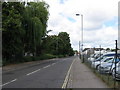


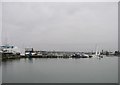

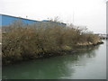
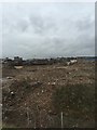
75 photos from this area
Area Information
Key information about the SO14 0FP including its size, population, and administrative classification.
- Area Type
- Postcode
- Area Size
- 3654 m²
- Population
- 2560
- Population Density
- 3763 people/km²
House Prices in SO14 0FP
18
Properties
£192,756
Average Sold Price
£150,000
Lowest Price
£235,000
Highest Price
Showing 18 properties
| Address | Type | Beds | Baths | Last Sale Price | Last Sale Date | |
|---|---|---|---|---|---|---|
| 2, Hamilton House, Meridian Way, Southampton, SO14 0FP | Flat | 3 | 2 | £229,000 | Sep 2023 | |
| 17, Hamilton House, Meridian Way, Southampton, SO14 0FP | Flat | 2 | 1 | £198,000 | Feb 2023 | |
| 12, Hamilton House, Meridian Way, Southampton, SO14 0FP | Flat | - | - | £160,000 | Aug 2022 | |
| 10, Hamilton House, Meridian Way, Southampton, SO14 0FP | Flat | 3 | 2 | £220,000 | Oct 2021 | |
| 3, Hamilton House, Meridian Way, Southampton, SO14 0FP | Flat | - | - | £150,000 | May 2021 | |
| 18, Hamilton House, Meridian Way, Southampton, SO14 0FP | Flat | - | - | £170,000 | Apr 2018 | |
| 5, Hamilton House, Meridian Way, Southampton, SO14 0FP | Flat | - | - | £235,000 | Apr 2018 | |
| 16, Hamilton House, Meridian Way, Southampton, SO14 0FP | Flat | 2 | 2 | £200,000 | Apr 2018 | |
| 14, Hamilton House, Meridian Way, Southampton, SO14 0FP | Flat | - | - | £209,950 | Apr 2018 | |
| 8, Hamilton House, Meridian Way, Southampton, SO14 0FP | Flat | - | - | £179,950 | Mar 2018 |
Page 1 of 2
Energy Efficiency in SO14 0FP
Amenities
Schools
| Rank | School | Type | Entry gender | Ages |
|---|
Explore more schools in this area
Go to Schools tabDemographics
Household Size
One person
most common
Accommodation Type
Flats
most common
Tenure
24
majority
Ethnic Group
White
most common
Religion
N/A
most common
Household Composition
N/A
most common
Age
47
median
Adults (30-64 years)
most common
Household Deprivation
N/A
with no deprivation
NS-SEC
16
in Lower managerial occupations
Explore more demographic insights in this area
Go to Demographics tabPlanning
Planning Constraints
- Flood RiskPremium
- Ramsar Wetland SitesPremium
- Area of Outstanding Natural BeautyPremium
- Protected Nature ReservePremium
- Protected WoodlandPremium