Area Overview for SN7 8RS
Photos of SN7 8RS
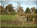
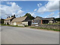
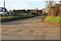
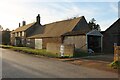

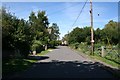
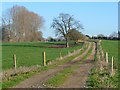
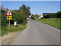
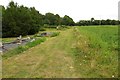


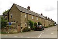
18 photos from this area
Area Information
Key information about the SN7 8RS including its size, population, and administrative classification.
- Area Type
- Postcode
- Area Size
- 5816 m²
- Population
- 2382
- Population Density
- 41 people/km²
House Prices in SN7 8RS
18
Properties
£290,032
Average Sold Price
£80,650
Lowest Price
£650,000
Highest Price
Showing 18 properties
| Address | Type | Beds | Baths | Last Sale Price | Last Sale Date | |
|---|---|---|---|---|---|---|
| 12 The Row, Hinton Waldrist, Faringdon, SN7 8RS | Cottage | 3 | 2 | £650,000 | Jul 2025 | |
| 7 The Row, Hinton Waldrist, Faringdon, SN7 8RS | Cottage | 3 | 2 | £386,197 | Jan 2019 | |
| 9 The Row, Hinton Waldrist, Faringdon, SN7 8RS | Terraced | 2 | 1 | £225,000 | Sep 2018 | |
| 8 The Row, Hinton Waldrist, Faringdon, SN7 8RS | Terraced | 2 | 1 | £278,000 | Feb 2015 | |
| 4 The Row, Hinton Waldrist, Faringdon, SN7 8RS | house | 4 | - | £360,000 | Aug 2012 | |
| 17 The Row, Hinton Waldrist, Faringdon, SN7 8RS | house | - | - | £247,000 | Jan 2012 | |
| 5 The Row, Hinton Waldrist, Faringdon, SN7 8RS | house | 3 | 2 | £295,000 | Oct 2010 | |
| 18 The Row, Hinton Waldrist, Faringdon, SN7 8RS | Terraced | 3 | 2 | £248,500 | Aug 2007 | |
| 10 The Row, Hinton Waldrist, Faringdon, SN7 8RS | Terraced | - | - | £215,000 | Jun 2006 | |
| 14 The Row, Hinton Waldrist, Faringdon, SN7 8RS | Terraced | - | - | £205,000 | Feb 2005 |
Page 1 of 2
Energy Efficiency in SN7 8RS
Amenities
Schools
| Rank | School | Type | Entry gender | Ages |
|---|
Explore more schools in this area
Go to Schools tabDemographics
Household Size
Two person
most common
Accommodation Type
Houses
most common
Tenure
77
majority
Ethnic Group
White
most common
Religion
N/A
most common
Household Composition
N/A
most common
Age
47
median
Adults (30-64 years)
most common
Household Deprivation
N/A
with no deprivation
NS-SEC
51
in Lower managerial occupations
Explore more demographic insights in this area
Go to Demographics tabPlanning
Planning Constraints
- Flood RiskPremium
- Ramsar Wetland SitesPremium
- Area of Outstanding Natural BeautyPremium
- Protected Nature ReservePremium
- Protected WoodlandPremium