Area Overview for SN6 8TH
Photos of SN6 8TH
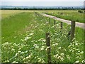
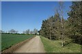
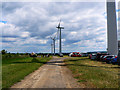

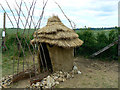


31 photos from this area
Area Information
Key information about the SN6 8TH including its size, population, and administrative classification.
- Area Type
- Postcode
- Area Size
- 3.8 km²
- Population
- 1511
- Population Density
- 115 people/km²
House Prices in SN6 8TH
13
Properties
£970,000
Average Sold Price
£880,000
Lowest Price
£1,060,000
Highest Price
Showing 13 properties
| Address | Type | Beds | Baths | Last Sale Price | Last Sale Date | |
|---|---|---|---|---|---|---|
| Westmill Farm, Highworth Road, Watchfield, Swindon, SN6 8TH | Detached | 4 | - | £1,060,000 | Oct 2025 | |
| Westmill House, Highworth Road, Watchfield, Swindon, SN6 8TH | house | 4 | 2 | £880,000 | Apr 2018 | |
| Tellhards Copse Cottage, Highworth Road, Watchfield, Swindon, SN6 8TH | Detached | - | - | - | - | |
| Waterloo Lodge, Section Of B 4019 Running Through Coleshill, Coleshill, Swindon, SN6 8TH | house | - | - | - | - | |
| 2, Westmill Farm Cottages, Highworth Road, Watchfield, Swindon, SN6 8TH | house | - | - | - | - | |
| Old Westmill Farmhouse, Highworth Road, Watchfield, Swindon, SN6 8TH | Detached | - | - | - | - | |
| The Barn, Old Westmill Farmhouse, Highworth Road, Watchfield, Swindon, SN6 8TH | Semi-detached | - | - | - | - | |
| The Coach House, Old Westmill Farmhouse, Highworth Road, Watchfield, Swindon, SN6 8TH | Terraced | - | - | - | - | |
| 1, Westmill Farm Cottages, Highworth Road, Watchfield, Swindon, SN6 8TH | house | - | - | - | - | |
| Strattenborough Castle Farm, Highworth Road, Watchfield, Swindon, SN6 8TH | Detached | - | - | - | - |
Page 1 of 2
Energy Efficiency in SN6 8TH
Amenities
Schools
| Rank | School | Type | Entry gender | Ages |
|---|
Explore more schools in this area
Go to Schools tabDemographics
Household Size
Family (3-5 people)
most common
Accommodation Type
Houses
most common
Tenure
55
majority
Ethnic Group
White
most common
Religion
N/A
most common
Household Composition
N/A
most common
Age
47
median
Adults (30-64 years)
most common
Household Deprivation
N/A
with no deprivation
NS-SEC
53
in Lower managerial occupations
Explore more demographic insights in this area
Go to Demographics tabPlanning
Planning Constraints
- Flood RiskPremium
- Ramsar Wetland SitesPremium
- Area of Outstanding Natural BeautyPremium
- Protected Nature ReservePremium
- Protected WoodlandPremium