Area Overview for SM7 3PE
Photos of SM7 3PE


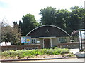
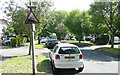
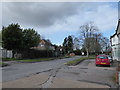
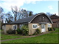
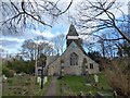
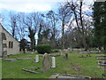
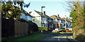
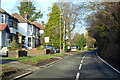
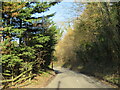
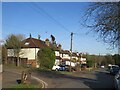
34 photos from this area
Area Information
Key information about the SM7 3PE including its size, population, and administrative classification.
- Area Type
- Postcode
- Area Size
- 6.7 hectares
- Population
- 1470
- Population Density
- 1547 people/km²
House Prices in SM7 3PE
29
Properties
£327,600
Average Sold Price
£132,000
Lowest Price
£535,000
Highest Price
Showing 29 properties
| Address | Type | Beds | Baths | Last Sale Price | Last Sale Date | |
|---|---|---|---|---|---|---|
| 61 Rectory Lane, Woodmansterne, SM7 3PE | Semi-detached | 3 | 2 | £440,000 | Sep 2024 | |
| 81 Rectory Lane, Woodmansterne, SM7 3PE | Semi-detached | 4 | 3 | £372,000 | Jun 2024 | |
| 49 Rectory Lane, Woodmansterne, SM7 3PE | Semi-detached | 3 | 2 | £475,000 | Feb 2024 | |
| 77 Rectory Lane, Woodmansterne, SM7 3PE | Semi-detached | 3 | 1 | £505,000 | May 2023 | |
| 43 Rectory Lane, Woodmansterne, SM7 3PE | house | - | - | £535,000 | May 2021 | |
| 75 Rectory Lane, Woodmansterne, SM7 3PE | Semi-detached | 3 | 1 | £425,000 | Mar 2020 | |
| 65 Rectory Lane, Woodmansterne, SM7 3PE | Semi-detached | 4 | 2 | £470,000 | Apr 2019 | |
| 73 Rectory Lane, Woodmansterne, SM7 3PE | house | 3 | - | £380,000 | Nov 2014 | |
| 57 Rectory Lane, Woodmansterne, SM7 3PE | house | 4 | - | £289,000 | Mar 2012 | |
| 51 Rectory Lane, Woodmansterne, SM7 3PE | Semi-detached | 3 | 1 | £265,000 | Jun 2011 |
Page 1 of 3
Energy Efficiency in SM7 3PE
Amenities
Schools
| Rank | School | Type | Entry gender | Ages |
|---|
Explore more schools in this area
Go to Schools tabDemographics
Household Size
Family (3-5 people)
most common
Accommodation Type
Houses
most common
Tenure
90
majority
Ethnic Group
White
most common
Religion
N/A
most common
Household Composition
N/A
most common
Age
47
median
Adults (30-64 years)
most common
Household Deprivation
N/A
with no deprivation
NS-SEC
41
in Lower managerial occupations
Explore more demographic insights in this area
Go to Demographics tabPlanning
Planning Constraints
- Flood RiskPremium
- Ramsar Wetland SitesPremium
- Area of Outstanding Natural BeautyPremium
- Protected Nature ReservePremium
- Protected WoodlandPremium