Area Overview for SM7 2DZ
Photos of SM7 2DZ
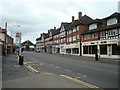
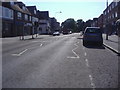
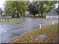
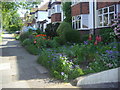
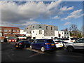
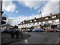
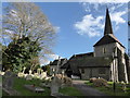
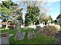
58 photos from this area
Area Information
Key information about the SM7 2DZ including its size, population, and administrative classification.
- Area Type
- Postcode
- Area Size
- 1.8 hectares
- Population
- 1239
- Population Density
- 1730 people/km²
House Prices in SM7 2DZ
15
Properties
£697,450
Average Sold Price
£200,000
Lowest Price
£1,515,000
Highest Price
Showing 15 properties
| Address | Type | Beds | Baths | Last Sale Price | Last Sale Date | |
|---|---|---|---|---|---|---|
| 9 Garratts Lane, Banstead, SM7 2DZ | Detached | 5 | 2 | £1,270,000 | Sep 2021 | |
| 7 Garratts Lane, Banstead, SM7 2DZ | Detached | 6 | 4 | £1,515,000 | Jan 2021 | |
| 4 Garratts Lane, Banstead, SM7 2DZ | Detached | 5 | 2 | £1,140,000 | Mar 2016 | |
| Squirrels Wood, 17 Garratts Lane, Banstead, SM7 2DZ | house | 4 | - | £840,000 | Jul 2015 | |
| 1 Garratts Lane, Banstead, SM7 2DZ | Detached | 2 | 1 | £406,500 | Jul 2007 | |
| 10 Garratts Lane, Banstead, SM7 2DZ | Detached | - | - | £480,000 | Dec 2005 | |
| Greentrees, 11A Garratts Lane, Banstead, SM7 2DZ | Detached | - | - | £595,000 | Sep 2004 | |
| 5 Garratts Lane, Banstead, SM7 2DZ | Detached | - | - | £315,000 | Feb 2001 | |
| Ballater, 11 Garratts Lane, Banstead, SM7 2DZ | Detached | - | - | £213,000 | May 1998 | |
| 8 Garratts Lane, Banstead, SM7 2DZ | Detached | - | - | £200,000 | May 1996 |
Page 1 of 2
Energy Efficiency in SM7 2DZ
Amenities
Schools
| Rank | School | Type | Entry gender | Ages |
|---|
Explore more schools in this area
Go to Schools tabDemographics
Household Size
Two person
most common
Accommodation Type
Houses
most common
Tenure
90
majority
Ethnic Group
White
most common
Religion
N/A
most common
Household Composition
N/A
most common
Age
47
median
Adults (30-64 years)
most common
Household Deprivation
N/A
with no deprivation
NS-SEC
48
in Lower managerial occupations
Explore more demographic insights in this area
Go to Demographics tabPlanning
Planning Constraints
- Flood RiskPremium
- Ramsar Wetland SitesPremium
- Area of Outstanding Natural BeautyPremium
- Protected Nature ReservePremium
- Protected WoodlandPremium