Area Overview for SM7 1DQ
Photos of SM7 1DQ
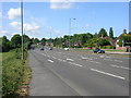
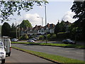
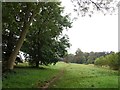
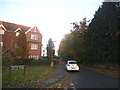

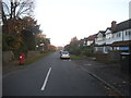
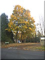
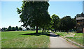
24 photos from this area
Area Information
Key information about the SM7 1DQ including its size, population, and administrative classification.
- Area Type
- Postcode
- Area Size
- 9.8 hectares
- Population
- 1249
- Population Density
- 1724 people/km²
House Prices in SM7 1DQ
18
Properties
£760,177
Average Sold Price
£329,950
Lowest Price
£1,650,000
Highest Price
Showing 18 properties
| Address | Type | Beds | Baths | Last Sale Price | Last Sale Date | |
|---|---|---|---|---|---|---|
| Spinney House, The Drive, Banstead, SM7 1DQ | Detached | 4 | 1 | £1,650,000 | Mar 2024 | |
| Chinaar, 25 The Drive, Banstead, SM7 1DQ | Detached | 4 | 2 | £840,000 | Oct 2017 | |
| 31 The Drive, Banstead, SM7 1DQ | Detached | 4 | - | £990,000 | Oct 2017 | |
| Little Burgh, The Drive, Banstead, SM7 1DQ | house | - | - | £1,175,000 | Mar 2016 | |
| Round Trees, 29 The Drive, Banstead, SM7 1DQ | house | 5 | 1 | £537,000 | Jan 2015 | |
| Tumble Cottage, 37 The Drive, Banstead, SM7 1DQ | house | 5 | - | £750,000 | Oct 2011 | |
| 27 The Drive, Banstead, SM7 1DQ | Detached | - | - | £430,000 | Jun 2006 | |
| 33 The Drive, Banstead, SM7 1DQ | Detached | - | - | £585,000 | Jul 2005 | |
| Park View, The Drive, Banstead, SM7 1DQ | Detached | - | - | £590,000 | Nov 2002 | |
| Fir Croft, The Drive, Banstead, SM7 1DQ | Detached | - | - | £485,000 | Jan 2000 |
Page 1 of 2
Energy Efficiency in SM7 1DQ
Amenities
Schools
| Rank | School | Type | Entry gender | Ages |
|---|
Explore more schools in this area
Go to Schools tabDemographics
Household Size
Two person
most common
Accommodation Type
Houses
most common
Tenure
91
majority
Ethnic Group
White
most common
Religion
N/A
most common
Household Composition
N/A
most common
Age
47
median
Adults (30-64 years)
most common
Household Deprivation
N/A
with no deprivation
NS-SEC
38
in Lower managerial occupations
Explore more demographic insights in this area
Go to Demographics tabPlanning
Planning Constraints
- Flood RiskPremium
- Ramsar Wetland SitesPremium
- Area of Outstanding Natural BeautyPremium
- Protected Nature ReservePremium
- Protected WoodlandPremium