Area Overview for Slough
Photos of Slough


Area Information
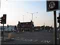
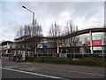
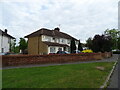
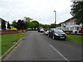
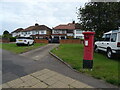
Living in Slough offers a defined residential experience within Bilt-up area status. The town covers 27.8 km² of land and holds a population of 64,989 residents. This density creates a built-up environment where daily life revolves around proximity to urban centres. With a population density of 2,341 people per km², the area maintains a substantial urban footprint without the sprawling feel of larger cities. Residents here access major transport links including Slough Railway Station and London Heathrow Airport. The location sits near key retail hubs like Asda Good and Aldi, which are situated on Farnham Road. Daily commutes often involve travel to Windsor or connections to Uxbridge. The infrastructure supports a mix of home ownership and rental living arrangements. You would find a community shaped by these transport arteries and local services. The area serves as a practical base for those working in London or the wider Thames Valley region. Specific names like Burnham Railway Station appear frequently on commuting maps for locals. The setting provides a clear geographical identity within the county of Berkshire. Understanding the size of Slough helps contextulise the distance to wider amenities. The built-up nature ensures that shops and services are within practical reach of most households in the town.
- Area Type
- District/Borough
- Area Size
- 27.8 km²
- Population
- 64989
- Population Density
- 2341 people/km²
Demographics
The community in Slough reflects specific demographic markers that define the local population profile. The median age stands at 70 years, indicating a significant proportion of older residents live in Slough. Household composition and accommodation type data cover the total population without specific breakdowns for individual household sizes. Home ownership accounts for 53% of all households in the town. This percentage suggests a balanced market where roughly half of residents own their properties while the other half rent. The ethnic group data covers the total population but does not provide specific percentages for individual groups. Similarly, religious affiliation data is recorded but not detailed in the provided information. Age distribution shows that the most common age range covers the total population spectrum. This high median age influences local service usage and community dynamics significantly. The 53% ownership rate impacts property investment strategies for new buyers entering Slough. You should note that over half the residents own their homes, which often correlates with stability. The total population figure of 64,989 draws from the 27.8 km² boundary. These facts create a clear picture of the demographic landscape without relying on unspecified estimates. The data confirms a mature community structure with a majority of owners.
Household Size
Accommodation Type
Tenure
Ethnic Group
Religion
Household Composition
Age
Household Deprivation
NS-SEC
Explore more demographic insights in this area
Go to Demographics tabPlanning
Planning Constraints
- Crime RiskPremium