Area Overview for SL9 7HE
Photos of SL9 7HE
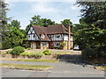
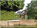
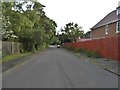
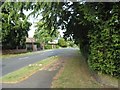
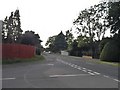
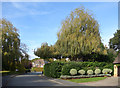
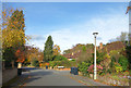

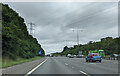
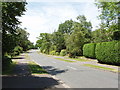
18 photos from this area
Area Information
Key information about the SL9 7HE including its size, population, and administrative classification.
- Area Type
- Postcode
- Area Size
- 2.6 hectares
- Population
- 1612
- Population Density
- 391 people/km²
House Prices in SL9 7HE
17
Properties
£1,477,727
Average Sold Price
£500,000
Lowest Price
£2,800,000
Highest Price
Showing 17 properties
| Address | Type | Beds | Baths | Last Sale Price | Last Sale Date | |
|---|---|---|---|---|---|---|
| Forest Glade, 82 Fulmer Drive, Gerrards Cross, SL9 7HE | Detached | 4 | 2 | £1,650,000 | May 2025 | |
| 80 Fulmer Drive, Gerrards Cross, SL9 7HE | Detached | 5 | 5 | £2,800,000 | May 2024 | |
| 96 Fulmer Drive, Gerrards Cross, SL9 7HE | Detached | 5 | 4 | £1,550,000 | Apr 2023 | |
| 86 Fulmer Drive, Gerrards Cross, SL9 7HE | house | - | - | £1,610,000 | Dec 2020 | |
| 76 Fulmer Drive, Gerrards Cross, SL9 7HE | Detached | 6 | 6 | £1,300,000 | Mar 2016 | |
| 102 Fulmer Drive, Gerrards Cross, SL9 7HE | house | 5 | - | £2,800,000 | Jan 2015 | |
| Oakdale, 100A Fulmer Drive, Gerrards Cross, SL9 7HE | house | - | - | £1,300,000 | Jan 2008 | |
| 98 Fulmer Drive, Gerrards Cross, SL9 7HE | Detached | - | - | £1,165,000 | Nov 2007 | |
| 94 Fulmer Drive, Gerrards Cross, SL9 7HE | Detached | - | - | £875,000 | Sep 2006 | |
| 92 Fulmer Drive, Gerrards Cross, SL9 7HE | Detached | - | - | £705,000 | Jun 2002 |
Page 1 of 2
Energy Efficiency in SL9 7HE
Amenities
Schools
| Rank | School | Type | Entry gender | Ages |
|---|
Explore more schools in this area
Go to Schools tabDemographics
Household Size
Family (3-5 people)
most common
Accommodation Type
Houses
most common
Tenure
80
majority
Ethnic Group
White
most common
Religion
N/A
most common
Household Composition
N/A
most common
Age
47
median
Adults (30-64 years)
most common
Household Deprivation
N/A
with no deprivation
NS-SEC
56
in Lower managerial occupations
Explore more demographic insights in this area
Go to Demographics tabPlanning
Planning Constraints
- Flood RiskPremium
- Ramsar Wetland SitesPremium
- Area of Outstanding Natural BeautyPremium
- Protected Nature ReservePremium
- Protected WoodlandPremium