Area Overview for SL9 7EF
Photos of SL9 7EF
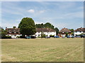
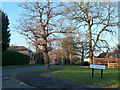
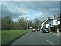


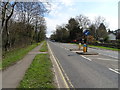
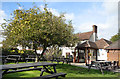
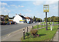
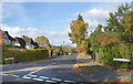
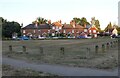
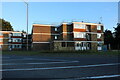

27 photos from this area
Area Information
Key information about the SL9 7EF including its size, population, and administrative classification.
- Area Type
- Postcode
- Area Size
- 1.8 hectares
- Population
- 2086
- Population Density
- 432 people/km²
House Prices in SL9 7EF
17
Properties
£1,049,667
Average Sold Price
£295,000
Lowest Price
£1,695,000
Highest Price
Showing 17 properties
| Address | Type | Beds | Baths | Last Sale Price | Last Sale Date | |
|---|---|---|---|---|---|---|
| Felbrigg, 68A Fulmer Road, Gerrards Cross, SL9 7EF | house | - | - | £1,695,000 | Jan 2022 | |
| The Hollies, 56 Fulmer Road, Gerrards Cross, SL9 7EF | Detached | 6 | 3 | £1,490,000 | Jun 2021 | |
| Woodlands, 66 Fulmer Road, Gerrards Cross, SL9 7EF | house | - | - | £1,325,000 | Mar 2021 | |
| Kathlyn House, 54 Fulmer Road, Gerrards Cross, SL9 7EF | Detached | 4 | 1 | £970,000 | Jan 2019 | |
| Rowan House, 48 Fulmer Road, Gerrards Cross, SL9 7EF | Detached | 5 | 4 | £1,425,000 | Jun 2018 | |
| Beech House, 48A Fulmer Road, Gerrards Cross, SL9 7EF | Detached | 5 | 5 | £1,690,000 | Mar 2018 | |
| Silver Birches, 64 Fulmer Road, Gerrards Cross, SL9 7EF | house | - | - | £1,275,000 | Apr 2016 | |
| White Gables, 60 Fulmer Road, Gerrards Cross, SL9 7EF | Detached | - | - | £620,000 | Dec 2004 | |
| Ambleside, 72 Fulmer Road, Gerrards Cross, SL9 7EF | house | - | - | £661,000 | May 2004 | |
| The Gatehouse, 62 Fulmer Road, Gerrards Cross, SL9 7EF | Detached | 5 | - | £490,000 | Dec 1999 |
Page 1 of 2
Energy Efficiency in SL9 7EF
Amenities
Schools
| Rank | School | Type | Entry gender | Ages |
|---|
Explore more schools in this area
Go to Schools tabDemographics
Household Size
Family (3-5 people)
most common
Accommodation Type
Houses
most common
Tenure
74
majority
Ethnic Group
White
most common
Religion
N/A
most common
Household Composition
N/A
most common
Age
47
median
Adults (30-64 years)
most common
Household Deprivation
N/A
with no deprivation
NS-SEC
46
in Lower managerial occupations
Explore more demographic insights in this area
Go to Demographics tabPlanning
Planning Constraints
- Flood RiskPremium
- Ramsar Wetland SitesPremium
- Area of Outstanding Natural BeautyPremium
- Protected Nature ReservePremium
- Protected WoodlandPremium