Area Overview for SL9 7AZ
Photos of SL9 7AZ
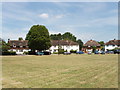
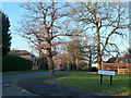
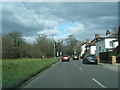
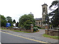

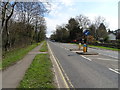
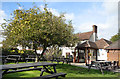
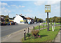
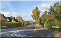
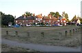
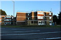
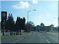
27 photos from this area
Area Information
Key information about the SL9 7AZ including its size, population, and administrative classification.
- Area Type
- Postcode
- Area Size
- 3.5 hectares
- Population
- 2086
- Population Density
- 432 people/km²
House Prices in SL9 7AZ
17
Properties
£368,917
Average Sold Price
£225,000
Lowest Price
£560,000
Highest Price
Showing 17 properties
| Address | Type | Beds | Baths | Last Sale Price | Last Sale Date | |
|---|---|---|---|---|---|---|
| 1 Oxford Road, Gerrards Cross, SL9 7AZ | Terraced | 3 | 1 | £470,000 | Feb 2025 | |
| 5 Oxford Road, Gerrards Cross, SL9 7AZ | Terraced | 3 | 2 | £378,500 | Sep 2024 | |
| 8 Oxford Road, Gerrards Cross, SL9 7AZ | Detached | 4 | 3 | £560,000 | Aug 2023 | |
| 2 Oxford Road, Gerrards Cross, SL9 7AZ | house | - | - | £255,000 | May 2015 | |
| 3 Oxford Road, Gerrards Cross, SL9 7AZ | house | 2 | - | £225,000 | Oct 2013 | |
| 4 Oxford Road, Gerrards Cross, SL9 7AZ | house | - | - | £325,000 | May 2007 | |
| Ground Floor Flat At, 6 Oxford Road, Gerrards Cross, SL9 7AZ | Flat | 1 | 1 | - | - | |
| Flat 4, Oxford Court, 9-10 Oxford Road, Gerrards Cross, SL9 7AZ | Flat | 1 | 1 | - | - | |
| Grafton Cottage, 7 Oxford Road, Gerrards Cross, SL9 7AZ | Semi-detached | 3 | 1 | - | - | |
| Normid House, 8-10 Oxford Road, Gerrards Cross, SL9 7AZ | Flat | - | - | - | - |
Page 1 of 2
Energy Efficiency in SL9 7AZ
Amenities
Schools
| Rank | School | Type | Entry gender | Ages |
|---|
Explore more schools in this area
Go to Schools tabDemographics
Household Size
Family (3-5 people)
most common
Accommodation Type
Houses
most common
Tenure
74
majority
Ethnic Group
White
most common
Religion
N/A
most common
Household Composition
N/A
most common
Age
47
median
Adults (30-64 years)
most common
Household Deprivation
N/A
with no deprivation
NS-SEC
46
in Lower managerial occupations
Explore more demographic insights in this area
Go to Demographics tabPlanning
Planning Constraints
- Flood RiskPremium
- Ramsar Wetland SitesPremium
- Area of Outstanding Natural BeautyPremium
- Protected Nature ReservePremium
- Protected WoodlandPremium