Area Overview for SL9 7AD
Photos of SL9 7AD
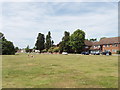
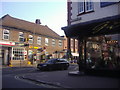
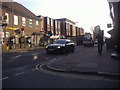
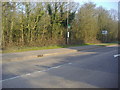
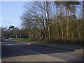
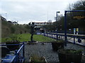
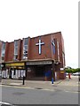
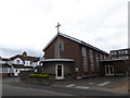
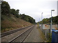
55 photos from this area
Area Information
Key information about the SL9 7AD including its size, population, and administrative classification.
- Area Type
- Postcode
- Area Size
- 5.8 hectares
- Population
- 1782
- Population Density
- 1587 people/km²
House Prices in SL9 7AD
7
Properties
£637,500
Average Sold Price
£480,000
Lowest Price
£795,000
Highest Price
Showing 7 properties
| Address | Type | Beds | Baths | Last Sale Price | Last Sale Date | |
|---|---|---|---|---|---|---|
| Ashmill House, 12 East Common, Gerrards Cross, SL9 7AD | Detached | - | - | £795,000 | May 2003 | |
| The Bolt, 11 East Common, Gerrards Cross, SL9 7AD | Semi-detached | - | - | £480,000 | Jan 1998 | |
| Fleming House, 10 East Common, Gerrards Cross, SL9 7AD | house | 6 | 4 | - | - | |
| The Colston Hall, The Memorial Centre, 8 East Common, Gerrards Cross, SL9 7AD | commercial | - | - | - | - | |
| Gerrards Cross Adult Learning Centre, The Memorial Centre, 8 East Common, Gerrards Cross, SL9 7AD | commercial | - | - | - | - | |
| Tennis 18M From 7 East Common 29M From East Common, East Common, Gerrards Cross, SL9 7AD | Leisure | - | - | - | - | |
| North Lodge, 7 East Common, Gerrards Cross, SL9 7AD | Bungalow | - | - | - | - |
Energy Efficiency in SL9 7AD
Amenities
Schools
| Rank | School | Type | Entry gender | Ages |
|---|
Explore more schools in this area
Go to Schools tabDemographics
Household Size
One person
most common
Accommodation Type
Houses
most common
Tenure
61
majority
Ethnic Group
White
most common
Religion
N/A
most common
Household Composition
N/A
most common
Age
47
median
Adults (30-64 years)
most common
Household Deprivation
N/A
with no deprivation
NS-SEC
54
in Lower managerial occupations
Explore more demographic insights in this area
Go to Demographics tabPlanning
Planning Constraints
- Flood RiskPremium
- Ramsar Wetland SitesPremium
- Area of Outstanding Natural BeautyPremium
- Protected Nature ReservePremium
- Protected WoodlandPremium